
Jewish Ghetto and Trastevere self-guided walking tour · about 80 minutes · map
Rome's Jewish Ghetto, Tiber Island and Trastevere on foot
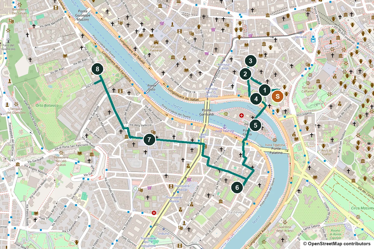
This walk starts where our Ancient Rome walk ends, at the Theatre of Marcellus. It goes through the former Jewish Ghetto, over Rome's best-preserved Roman bridge to Tiber Island and into Trastevere, ending at a banker's villa painted by Raphael.
On 12 July 1555 Pope Paul IV ordered Rome's Jews into a walled quarter beside the Theatre of Marcellus, with gates shut from sunset to dawn. In ancient times many of them had lived across the river, in Trastevere, a name that comes from the Latin trans Tiberim, across the Tiber. Pius IX had the ghetto wall pulled down in 1848, and the ghetto was abolished when Rome became part of the Kingdom of Italy in 1870.
A note on accuracy: most of the old ghetto was demolished from 1888, and the streets you walk were laid out then. The turtles on the Turtle Fountain are copies, and the bridge into Trastevere was rebuilt in the 1880s. Where that happens, we say so, and every fact links to its source.
- Start
- The Theatre of Marcellus, end of our Ancient Rome walk; the Arenula/Cairoli tram stop is about 370 m away
- Finish
- Villa Farnesina, Via della Lungara 230, where buses 23 and 280 stop
- Distance
- 2.8 km, one way
- Time
- About 80 minutes: 37 min walking and 8 stops, plus any visit to the synagogue, the churches or the villa
Terrain, water, opening days and a shorter version ↓
What to see: the stops
-
The Portico d'Ottavia and the plaque for 16 October 1943
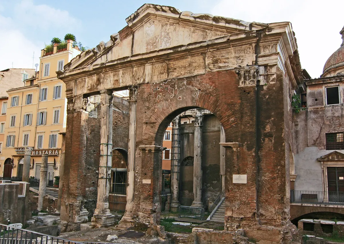
The entrance of the Portico, with Sant'Angelo in Pescheria behind the arch. Photo: Jensens (derivative work by Ptyx), public domain, via Wikimedia Commons (resized). From the Theatre of Marcellus, follow the path along its arches west to Via del Foro Piscario and the small square called Largo 16 Ottobre 1943. The brick and marble gateway in front of you was the entrance to a walled colonnade around two temples, of Juno Regina and Jupiter Stator. Augustus rebuilt it in his sister Octavia's name between 27 and 23 BC, but what stands is a later rebuild: the inscription on top records its restoration by Septimius Severus and Caracalla, after a fire. On a wall in the square, a plaque from 25 October 1964 says that here, on 16 October 1943, "the merciless hunt for the Jews" began. That Saturday, from 5:30 in the morning to 2 in the afternoon, German SS and police arrested 1,259 people, mostly in Via del Portico d'Ottavia and the streets around it. After some were released, 1,023 were deported to Auschwitz. Sixteen came back: 15 men and one woman, Settimia Spizzichino. A second plaque, put up by the city in 2001, remembers the babies killed in the camps: "And they did not even begin to live".
More history
An earthquake in 442 brought down two of the entrance's columns; the brick arch replaced them. Around 770 the church of Sant'Angelo in Pescheria was built into the ruin. The name means "in the fish market": fish was sold here from the Middle Ages until 1885. A stone in the church porch ordered that the head of any fish longer than the stone, down to the first fins, be handed to the city's magistrates.
Sources: Wikipedia (it), Portico di Ottavia; Wikipedia, Porticus Octaviae; Wikipedia (it), Rastrellamento del ghetto di Roma; LaPresse, 16 October 2023; plaque text on Wikimedia Commons and Wikimedia Commons; Wikipedia (it), Ghetto di Roma.
-
Via del Portico d'Ottavia and the house of Lorenzo Manilio
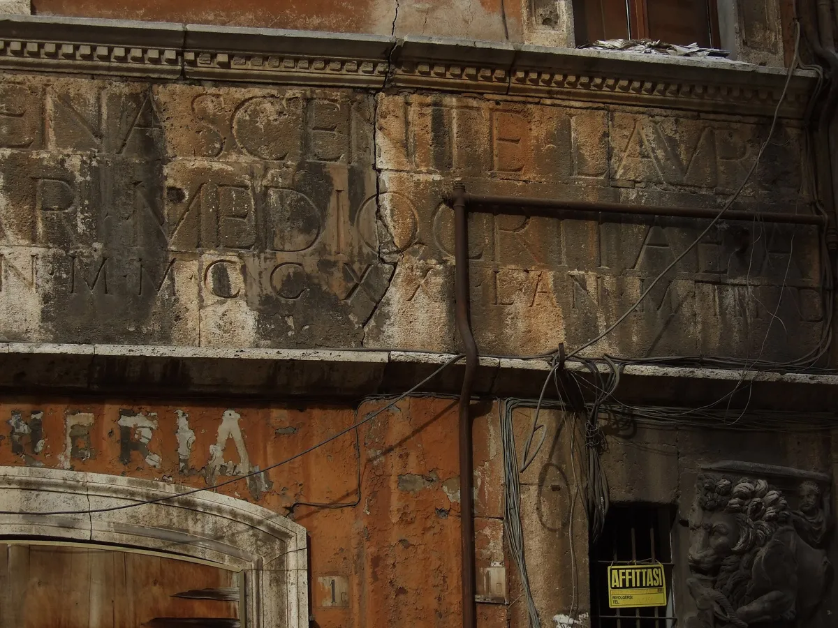
Part of the Latin inscription on the house of Lorenzo Manilio. Photo: Jenni Ahonen, CC BY-SA 4.0, via Wikimedia Commons (resized). Walk west along Via del Portico d'Ottavia. The street was cut in the 1888 clearances, in place of the old Via della Pescheria, but the row of older houses on its north side, your right, gives an idea of how the ghetto looked. Number 13, one of its two Renaissance palaces, was known locally as "il portonaccio"; many of those deported in 1943 were dragged out of it. Near the far end, at numbers 1 and 2, is the house Lorenzo Manilio built in 1468, nearly a century before the ghetto. Its marble band carries a long Latin inscription saying, roughly, that as Rome was reborn to its ancient form, Lorenzo Manilio, out of love for his city, built this house from its foundations, as far as his modest means allowed, for himself and his descendants, and dates it 2221 years from the founding of Rome. His name is repeated on the architraves, three times in Latin and once in Greek, Ave Roma is carved over the windows, and ancient Roman finds are set into the base.
More history
The street's restaurants serve two dishes from ghetto kitchens. Poor families made brodo di pesce, fish soup, from the heads and bones thrown away at the fish market, and carciofi alla giudia are Roman artichokes deep-fried in oil.
Sources: Turismo Roma, Rione Sant'Angelo; Wikipedia (it), Sant'Angelo; Wikipedia (it), Ghetto di Roma.
-
The Turtle Fountain in Piazza Mattei
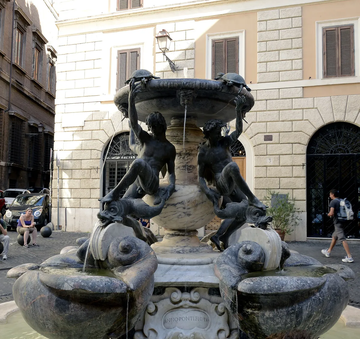
The fountain in Piazza Mattei. Photo: Livioandronico2013, CC BY-SA 4.0, via Wikimedia Commons (resized). Turn right up Via della Reginella to Piazza Mattei. When the old Acqua Vergine aqueduct was restored in 1570, Rome planned new fountains along it, and one was meant for Piazza Giudea, the ghetto's market square. Muzio Mattei, a nobleman on the planning committee, had it moved to this little square in front of his family's houses; in return he paid to pave the square and keep the fountain. Giacomo della Porta probably designed it, and the young sculptor Taddeo Landini made the four bronze youths, each with a foot on a dolphin. It was built between 1581 and 1588. The turtles came in a restoration under Pope Alexander VII in 1658 and are credited to Bernini or Andrea Sacchi; the pope's inscription is on the basin. They have been stolen more than once. After a theft in 1979 the originals went to the Capitoline Museums, so the turtles you see are copies.
More history
During the 1943 raid Achille Afan de Rivera and his wife Giulia Florio, who lived in the Palazzo Costaguti on this square, let fugitives in by a back door and out by the front, and hid 16 families.
Sources: Wikipedia (it), Fontana delle Tartarughe; Wikipedia, Fontana delle Tartarughe; Wikipedia (it), Rastrellamento del ghetto di Roma; Wikipedia (it), Sant'Angelo.
-
The Great Synagogue and the Jewish Museum
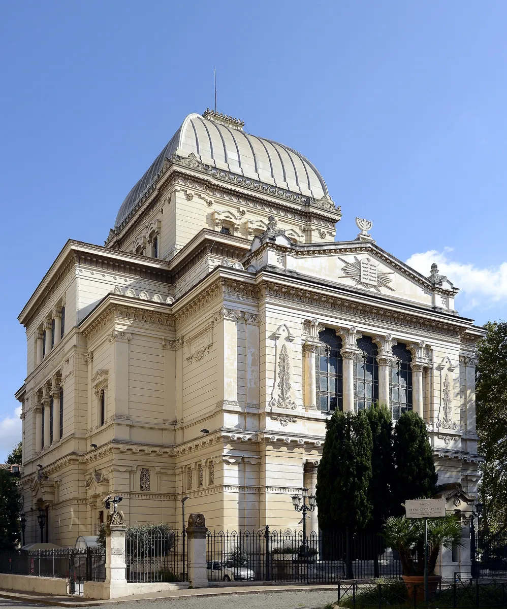
The synagogue from the riverside. Photo: Livioandronico2013, CC BY-SA 4.0, via Wikimedia Commons (resized). Walk back down Via della Reginella, turn left along Via del Portico d'Ottavia, then right down Via del Tempio to the riverside. In the ghetto, Rome's five congregations, the Cinque Scole, shared a single building. After 1870 the community wanted one monumental synagogue as a sign of its emancipation. In 1897 it bought one of the four plots left by the demolished ghetto, and Osvaldo Armanni and Vincenzo Costa built it from 1901 to 1904. They mixed Assyrian, Egyptian and Greek forms, under a square dome covered in aluminium. In September 1943 the gold that Herbert Kappler demanded from the community was collected here; it did not prevent the raid. On 9 October 1982 terrorists attacked worshippers leaving the synagogue and killed a two-year-old boy, Stefano Gaj Taché; the square by the side is named after him. On 13 April 1986 John Paul II made an unexpected visit here, the first known visit by a pope to a synagogue since the early history of the Church. You can go in with a ticket to the Jewish Museum, entered from Via Catalana, which includes a guided tour of the synagogue.
More history
The museum opened in 1960. Since 1932 a Spanish Synagogue has met inside the building, and in 1948 it was fitted with marble furnishings from the Cinque Scole.
Sources: Wikipedia (it), Tempio Maggiore di Roma; Wikipedia, Great Synagogue of Rome; Wikipedia (it), Museo ebraico; Jewish Museum of Rome, the synagogues. Visiting: opening times and tickets on the museum's site.
-
Ponte Fabricio and Tiber Island
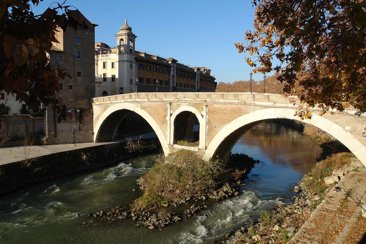
Ponte Fabricio, with the hospital on Tiber Island behind. Photo: Pascal Reusch, CC BY-SA 3.0, via Wikimedia Commons (resized). Cross the riverside road and walk over Ponte Fabricio to Piazza di San Bartolomeo all'Isola. Lucius Fabricius, the official in charge of Rome's roads, built the bridge in 62 BC; his name is carved four times on its arches. Rome's tourism office calls it the best-preserved Roman bridge and, with the Milvian Bridge, the oldest still in use. The brick facing comes from repairs in the 1600s. The two four-headed marble pillars on the parapet gave it the name Ponte dei Quattro Capi, and its place by the ghetto earned it another, the Jews' Bridge. The island became a place of healing after a plague in the early 3rd century BC, when Rome brought the cult of Aesculapius, god of medicine, here. The church of San Bartolomeo stands where his temple was, and the island's hospital dates from 1584. In October 1943 its doctors took in Jews fleeing the raid and declared them patients with a fatal, highly contagious illness, "Syndrome K", which they had invented as cover. The ruse saved about 100 people.
More history
The island is about 270 m long and was shaped like a ship in Roman times, with travertine facing at its ends. One of the hospital's doctors, Giovanni Borromeo, was later recognised by Yad Vashem as Righteous Among the Nations.
Sources: Turismo Roma, Pons Fabricius; Wikipedia (it), Ponte Fabricio; Wikipedia, Pons Fabricius; Wikipedia (it), Isola Tiberina; Wikipedia, Tiber Island; Wikipedia, Syndrome K.
-
Santa Cecilia in Trastevere
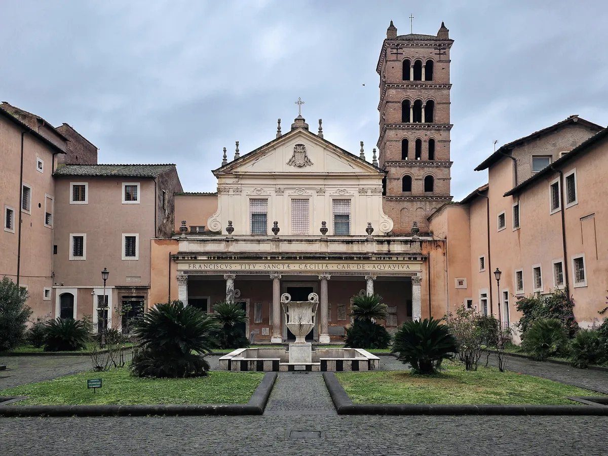
The courtyard and church front, with Cardinal Acquaviva's name. Photo: NateBergin, CC BY 4.0, via Wikimedia Commons (resized). Cross Ponte Cestio into Trastevere. Its Roman predecessor was pulled down in 1885 and rebuilt by 1889, with some of the old stone put back on the central arch. Take Via Titta Scarpetta, Via dei Salumi and Via dei Vascellari to Piazza di Santa Cecilia. Tradition says the church stands on the house of Cecilia, a Roman martyr and the patron saint of music. Pope Paschal I built the basilica in 822 and brought her body here. In 1599 Cardinal Sfondrati opened her tomb and found the body almost whole; Stefano Maderno's marble statue under the high altar shows her as she was found. Ferdinando Fuga designed the front and courtyard in the 18th century for Cardinal Francesco Acquaviva, whose name runs across it. Inside are Arnolfo di Cambio's altar canopy of 1293 and, in the nuns' choir, Pietro Cavallini's fresco of the Last Judgement. The fresco can be seen on weekday mornings, 10:00 to 12:30; the church also opens in the late afternoon. Under the church are remains of a Roman house of the 2nd century BC.
More history
Benedictine nuns have lived in the monastery next door since 1527 and look after the basilica. The Cavallini fresco was hidden behind a wooden vault and forgotten for centuries; it was found early in the 20th century, when a new nuns' choir was built.
Sources: Wikipedia (it), Basilica di Santa Cecilia in Trastevere; Wikipedia, Santa Cecilia in Trastevere; Wikipedia (it), Ponte Cestio. Visiting: opening times on the Benedictine nuns' site.
-
Santa Maria in Trastevere and its mosaics
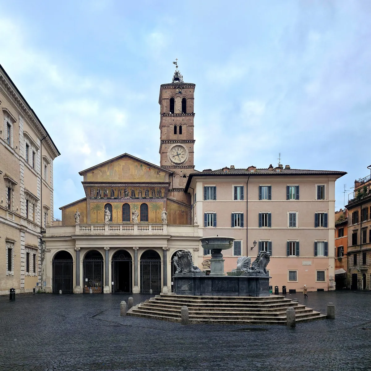
The church and the fountain in the square. Photo: NateBergin, CC BY 4.0, via Wikimedia Commons (resized). Walk west along Via dei Genovesi, turn into Via di Monte Fiore, cross the wide Viale di Trastevere and follow Via della Lungaretta into Piazza di Santa Maria in Trastevere. Tradition says Pope Callixtus I founded a church here in the early 3rd century and Julius I finished it in the 4th; it is one of the oldest churches in Rome. What you see was rebuilt in 1138–43 under Innocent II, with granite columns taken from the Baths of Caracalla. High on the front, a 13th-century mosaic shows Mary nursing the Child between ten women carrying lamps. Carlo Fontana added the porch in 1702. Inside, the 12th-century apse mosaic shows Christ and Mary sharing one throne, with Innocent II holding a model of his church. Below it, Pietro Cavallini's mosaics of the life of the Virgin date from 1291. The octagonal fountain in the square already appears on a map of 1472; Fontana restored it too.
More history
In a side chapel hangs the Madonna della Clemenza, an icon dated to somewhere between the 6th and 9th centuries. The palace on the south side of the square, Palazzo di San Callisto, built in 1610–18, is an extraterritorial property of the Holy See.
Sources: Wikipedia (it), Basilica di Santa Maria in Trastevere; Wikipedia, Santa Maria in Trastevere; Wikipedia (it), Piazza di Santa Maria in Trastevere.
-
Villa Farnesina, Raphael's Galatea
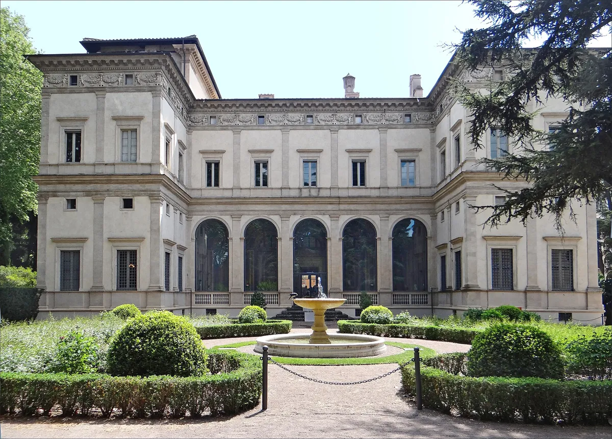
The garden front, with the glazed loggia in the middle. Photo: Jean-Pierre Dalbéra, CC BY 2.0, via Wikimedia Commons (resized). Leave the square past Piazza di Sant'Egidio and walk north up Via della Scala. At its end, cross the mouth of Via Corsini and follow Via della Lungara to number 230. Baldassarre Peruzzi built this villa from 1506 to 1512 for Agostino Chigi, a hugely rich banker from Siena. It was the first noble suburban villa in Rome. From 1511 Chigi had it painted by Peruzzi, Sebastiano del Piombo, Sodoma and Raphael with his pupils. Raphael's nymph Galatea rides a shell drawn by dolphins in the room named after her, and he and his workshop painted the story of Cupid and Psyche in the garden loggia, with festoons dated 1517; its five arches are now glazed to protect the frescoes. Cardinal Alessandro Farnese bought it around 1580, which gave it its name. The state has owned it since 1927, and the Accademia dei Lincei uses it. It opens Monday to Saturday from 9:00 to 14:00, so start the walk early if you want to go in.
More history
The riverside road opened in 1884 and destroyed part of the gardens and a loggia on the river that may have been designed by Raphael.
Sources: Wikipedia (it), Villa Farnesina; Wikipedia, Villa Farnesina; Villa Farnesina, the Loggia of Galatea. Visiting: hours and information on the villa's site.


Practical details
- Terrain
- Nearly flat, with no real climbs: the whole route runs through the low ground by the river. Cobbles and narrow lanes in the ghetto and Trastevere, with one busy road to cross on Viale di Trastevere.
- Step-free
- Not quite. OpenStreetMap maps several short flights of steps right on the route: a few at the riverside by the Great Synagogue (stop 4), and a few on and around Tiber Island between stops 5 and 6, including one of 11 steps with a handrail near Ponte Cestio. It does not record whether the nearby tram stops are wheelchair accessible.
- Water
- OpenStreetMap lists drinking fountains on the route at the Trastevere end of Ponte Cestio, on Via dei Vascellari just before Santa Cecilia, and where Via della Scala meets Via della Lungara, before the villa.
- Toilets
- OpenStreetMap maps one public toilet on the route, below street level near where the walk crosses Viale di Trastevere, between stops 6 and 7. Otherwise, plan on a café.
- Sit and eat
- Via del Portico d'Ottavia (stop 2) is lined with restaurants serving Roman Jewish dishes. In Trastevere, Piazza di Santa Maria (stop 7) and Via della Lungaretta have plenty of cafés and restaurants.
- When to go
- The Jewish Museum and Great Synagogue are closed on Saturdays and Jewish holidays. From 1 to 24 October they open Sunday to Thursday 10:00–17:00 and Friday 9:00–14:00, with shorter winter hours; a full ticket is €12. Villa Farnesina opens Monday to Saturday 9:00–14:00 (last entry 13:15) and the second Sunday of each month 9:00–17:00; a full ticket is €12. Cavallini's fresco at Santa Cecilia can be seen on weekdays 10:00–12:30. A weekday morning, not Friday afternoon, fits all three.
- Shorter walk
- Finish at stop 7, Santa Maria in Trastevere: 2.1 km and 28 minutes of walking, about an hour with stops.
- Getting back
- Buses 23 and 280 stop on Via della Lungara, by the villa, according to the villa's site.
Walking distances and times from the OSRM foot router on OpenStreetMap data. Stations, fountains and toilets from OpenStreetMap; opening times and prices from the Jewish Museum of Rome, Villa Farnesina and the Benedictine nuns of Santa Cecilia. Checked 5 October 2026.
Questions people ask
Is there a self-guided walking tour of the Jewish Ghetto in Rome with a map?
Yes, this one. The map is on this page, and you can print it or save it as a PDF. The ghetto part covers four stops in about 640 m: the Portico d'Ottavia and the 1943 plaque, Via del Portico d'Ottavia, the Turtle Fountain and the Great Synagogue. The whole walk, on to Trastevere, is 2.8 km and about 80 minutes with eight stops.
What is the Jewish Ghetto in Rome?
The walled quarter beside the Theatre of Marcellus where Pope Paul IV forced Rome's Jews to live from 1555. Its gates were shut from sunset to dawn. Pius IX had the wall pulled down in 1848, and the ghetto was abolished when Rome joined the Kingdom of Italy in 1870. Most of it was demolished from 1888; the Great Synagogue now stands on part of the cleared ground.
Is the Great Synagogue of Rome open to visitors?
Yes, with a ticket to the Jewish Museum of Rome, entered from Via Catalana. The ticket includes the museum and a guided tour of the synagogue. The museum is closed on Saturdays and Jewish holidays and closes early on Fridays; check the museum's site before you go.
What is the oldest bridge in Rome?
Ponte Fabricio, built in 62 BC from the ghetto side to Tiber Island. Rome's tourism office calls it the best-preserved Roman bridge and, with the Milvian Bridge, the oldest still in use. Stop 5 of this walk crosses it.
Is Trastevere walkable from the centre, and what is it known for?
Yes. From Campo de' Fiori to Piazza di Santa Maria in Trastevere is about 825 m, 11 minutes on foot, and from the Pantheon about 1.5 km, 20 minutes. The name means across the Tiber. It is known for its narrow lanes and small squares and for its churches, among them Santa Maria in Trastevere, one of the oldest in Rome, and Santa Cecilia.
Walk it with Strolio
Open Strolio at the Theatre of Marcellus and ask for an hour and a half through the Jewish Ghetto and Trastevere. Strolio builds walks in any city with mapped streets, so its route may pick different stops from this page. Stories play as you reach each place, and you can ask about anything else you pass, by voice or with a photo. You can also start from your hotel and choose your own time and interests.
More walks in Rome
- The historic centre: ~70 min, 7 stops. From the square where Giordano Bruno was burned, past the Pantheon and Bernini's elephant, to the Trevi Fountain and the Spanish Steps.
- Ancient Rome: ~90 min, 8 stops. Round the Colosseum, past Trajan's Column, up Michelangelo's Capitoline to a free view over the Forum.
- Castel Sant'Angelo to St Peter's: ~75 min, 8 stops. Bernini's angels, an avenue begun under Mussolini, the Passetto, the Swiss Guard and the Vatican walls.
- All Rome walks, with maps side by side.
- Walks in other cities.
Sources
- Wikipedia (Italian): Ghetto di Roma, Rastrellamento del ghetto di Roma, Portico di Ottavia, Sant'Angelo, Fontana delle Tartarughe, Tempio Maggiore di Roma, Museo ebraico, Ponte Fabricio, Ponte Cestio, Isola Tiberina, Santa Cecilia in Trastevere, Santa Maria in Trastevere, Piazza di Santa Maria in Trastevere, Villa Farnesina, Trastevere
- Wikipedia (English): Porticus Octaviae, Fontana delle Tartarughe, Great Synagogue of Rome, Pons Fabricius, Tiber Island, Syndrome K, Santa Cecilia in Trastevere, Santa Maria in Trastevere, Villa Farnesina, Trastevere
- Turismo Roma, the city's tourism site: Pons Fabricius, Rione Sant'Angelo. We used their facts and wrote our own text.
- The 1943 plaques: LaPresse; transcriptions and photos on Wikimedia Commons
- Opening times, prices and visits: Jewish Museum of Rome, Villa Farnesina, Benedictine nuns of Santa Cecilia
- Map data and places: © OpenStreetMap contributors, ODbL; walking route from the OSRM foot router run by FOSSGIS
- Photos: Wikimedia Commons contributors Jensens and Ptyx, Jenni Ahonen, Livioandronico2013, Pascal Reusch, NateBergin and Jean-Pierre Dalbéra, credited under each photo