
Vila Nova de Gaia self-guided walking tour · 1.5 hours · map
Across the river to Gaia: port wine lodges, rabelo boats and the Serra do Pilar
Vila Nova de Gaia faces Porto across the Douro, and Port wine has aged in its lodges for centuries. This walk crosses the river on the lower deck of the Luís I bridge, follows the quay past the rabelo boats and the lodges, climbs to a garden and a round monastery church, and comes back to Porto over the top deck.
Gaia is its own city, not part of Porto: a municipality on the south bank with 303,824 people in 2021, more than any other municipality in northern Portugal. From 1926 Port had to be stored here and nowhere else, and only in 1986 were producers allowed to sell straight from the Douro valley. The Serra do Pilar monastery belongs to the same UNESCO World Heritage Site as Porto's historic centre.
This walk starts where our Porto historic centre walk ends, on the bridge's lower deck. The lodges' histories come from the companies' own sites, we say where sources disagree, and every fact links to its source.
- Start
- The lower deck of the Luís I bridge, at the east end of Porto's Ribeira quay
- Finish
- The Porto end of the bridge's upper deck, about 400 m on foot from São Bento metro station
- Distance
- 3.4 km, one way
- Time
- About 1.5 hours: 45 min walking, 8 stops and one steep climb; more with a port lodge visit
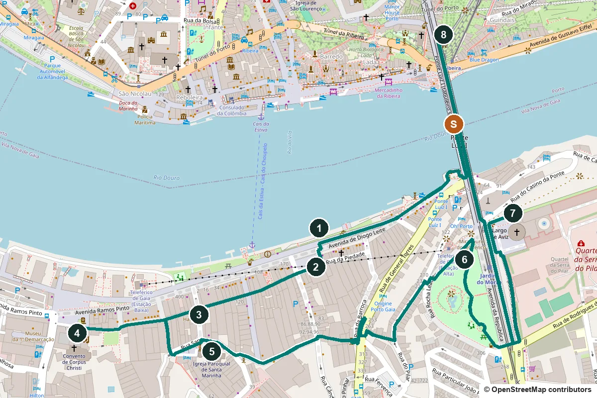
Terrain, water, opening times and a shorter version ↓
What to see: the stops
-
Cais de Gaia and the rabelo boats
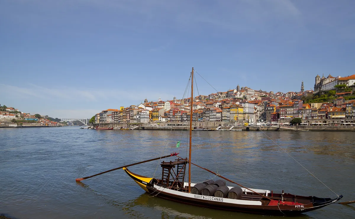
A rabelo moored at Gaia, with Porto across the river. Photo: Diego Delso, CC BY-SA 3.0, via Wikimedia Commons (resized). Walk south across the bridge's lower deck to the Gaia bank and turn right onto the riverside path. For centuries this was a river port, shipping many goods, above all Port wine: cargo ships tied up here to load casks and crates of bottles. It declined when the mouth of the Douro silted up and the port of Leixões was built. Today's promenade, lined with terraces and restaurants, was designed by the architect Tasso de Sousa with Eduardo Cabral dos Santos and built from 2000 to 2003. The wooden boats moored along it are rabelos. They carried pipes, the big casks of Port, down the river from the vineyards of the Upper Douro to the lodges in Gaia. A rabelo has a flat bottom and no keel, for the shallow, fast upper river, one square sail and a hull of overlapping planks, built the northern European way. It is 19 to 23 m long, was usually worked by six or seven men and steered with a long oar at the stern; rabelo means "little tail", after that oar.
More history
The Douro railway, finished in 1887, and then the roads took the rabelos' trade; by 1961 only six were still in regular work, and from the 1960s dams changed the river. The rabelos you see now belong to Port wine companies, and on 24 June, St John's Day, they race in Porto's festival.
Sources: Wikipedia (pt), Cais de Gaia; Câmara Municipal de Vila Nova de Gaia, visitor guide (2026); Wikipedia (pt), Barco rabelo; Wikipedia, Rabelo boat; Instituto dos Vinhos do Douro e do Porto, historical milestones.
-
Sandeman's lodge and The Don
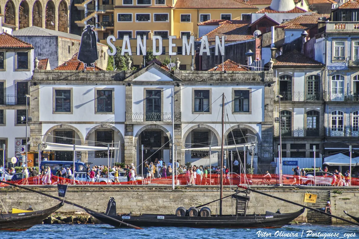
The Sandeman lodge from the river. Photo: Vitor Oliveira, CC BY-SA 2.0, via Wikimedia Commons (resized). Walk a few steps inland to Largo de Miguel Bombarda; the lodge is at number 47. George Sandeman, a 25-year-old Scot, set up as a wine merchant in London in 1790 with a £300 loan from his father. In 1811 he bought lodges here to store Port before shipping. Sandeman says this arcaded building probably dates from 1797 and holds more than 2,000 casks. The black caped figure on the roof is The Don. George Massiot-Brown, a Scot who signed himself "G. Massiot", painted him for a poster in 1928, in a Portuguese student's cape and a Spanish hat; he has been on the labels since 1934. Visits are paid and booked on Sandeman's site. In 2026 the shortest, 50 minutes with three Ports, costs €23.
More history
Many of Gaia's wine warehouses were built or rebuilt in the 17th and 18th centuries, with brick arches and vaults under wooden upper floors. The 19th-century writer Camilo Castelo Branco called Gaia "the biggest tavern in the world", and the Liberal Revolution of 1820 was partly planned in its wine cellars.
Sources: Sandeman, history; Sandeman, visit the cellars; Wikipedia, Sandeman; Instituto dos Vinhos do Douro e do Porto; Câmara Municipal de Vila Nova de Gaia; Wikipedia, Vila Nova de Gaia.
-
Bordalo II's Half-Rabbit and the cable car
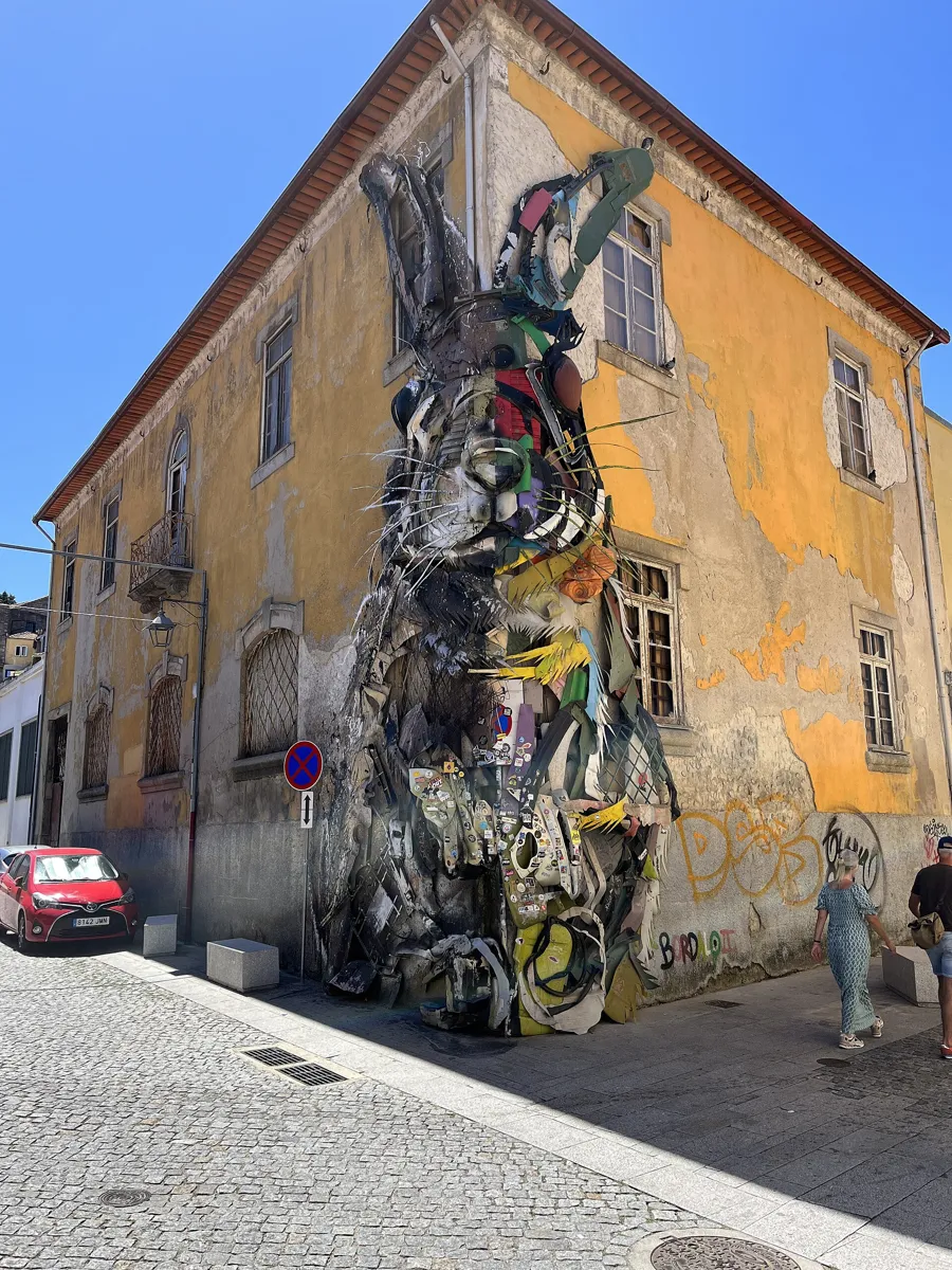
The Half-Rabbit on the Ramos Pinto warehouse. Photo: dlovins99, CC0, via Wikimedia Commons (resized). Leave the square by Rua Guilherme Gomes Fernandes and follow it west to the corner of Rua de Dom Afonso III. The giant rabbit climbing the corner of a Ramos Pinto warehouse is the Half-Rabbit, by the Lisbon-born street artist Bordalo II, Artur Bordalo. It has been here since 2017, put up through the Gaia Todo um Mundo initiative. It belongs to his Big Trash Animals series: animals built from rubbish such as old tyres, car parts and plastic, to point at waste and at the species it destroys. Like his other "half-half" pieces, one side looks real and the other is splashed with paint. About 170 m west, on Avenida Ramos Pinto, the Gaia cable car, open since April 2011, runs 562 m along the river and up to the Jardim do Morro; a one-way adult ticket costs €7 in 2026. To skip the climb, ride it up and rejoin the walk at stop 6.
More history
Bordalo chose the name Bordalo II in honour of his grandfather, the painter Real Bordalo. The cable car, built by Doppelmayr, normally runs at a slow 2.5 m a second so that riders can enjoy the view.
Sources: Câmara Municipal de Vila Nova de Gaia; Wikipedia, Bordalo II; Wikipedia (pt), Bordalo II; Wikipedia, Gaia Cable Car; Wikipedia (pt), Teleférico de Gaia; Gaia Cable Car, prices and timetable.
-
Corpus Christi, the convent church that moved up from the floods
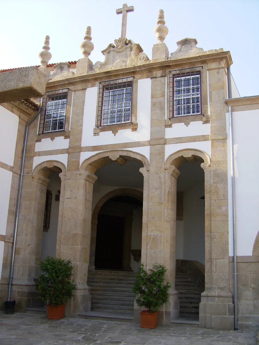
The church front. Photo: Carlos Luis M C da Cruz, public domain, via Wikimedia Commons (resized). Continue west along Rua Guilherme Gomes Fernandes to Largo de Aljubarrota and the convent's church. Maria Mendes Petite, a Gaia noblewoman, founded it in 1345 for Dominican nuns; a legal fight with the bishop of Porto delayed the opening until 1354. Its first church stood by the river, and the Douro's floods slowly ruined it. So in the second half of the 17th century work began on a new church on higher ground, designed by the priest Pantaleão da Rocha de Magalhães on the model of the Bom Sucesso convent in Belém. The Baroque front came in the 18th century and shows the influence of Nicolau Nasoni. The last nun died in 1894. Since 2003 it has belonged to the town council, as the Espaço Corpus Christi cultural venue, and since 2012 it has been listed as a Monument of Public Interest.
More history
Inside is the tomb chest of Álvaro Anes de Cernache, who carried the banner of the Ala dos Namorados, the "lovers' wing", at the battle of Aljubarrota in 1385. Leonor de Alvim, wife of the Constable Nuno Álvares Pereira, is buried here too.
Sources: Wikipedia (pt), Convento de Corpus Christi; Câmara Municipal de Vila Nova de Gaia; Wikipedia, Tourism in Vila Nova de Gaia.
-
Santa Marinha, the parish church Nasoni rebuilt
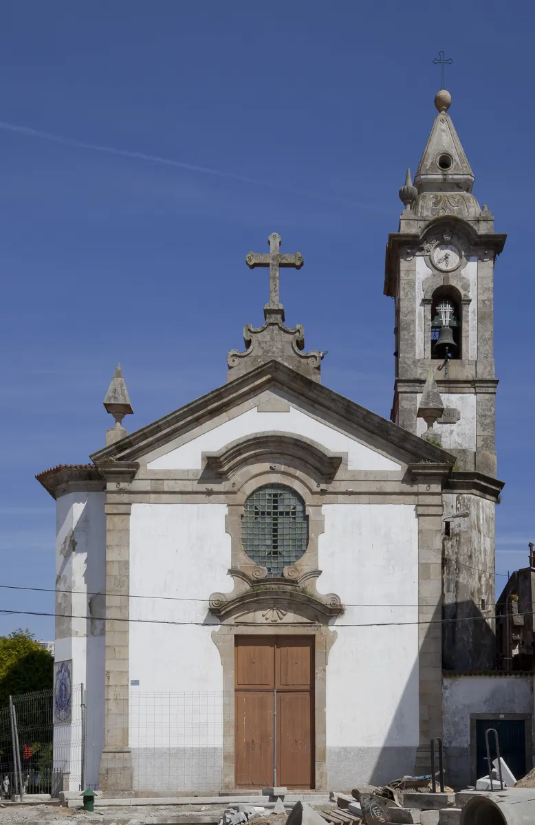
The church of Santa Marinha. Photo: Diego Delso, CC BY-SA 3.0, via Wikimedia Commons (resized). Walk back east along the street you came by for about 150 m, then turn right into Travessa do Ribeirinho and take a short path up to Rua Santa Marinha. A 10th-century church, part of a monastery, came first; the present one dates from the 16th century and was changed many times. In 1745 it was rebuilt under Nicolau Nasoni, chosen by the cathedral chapter of Porto, and it is now a Baroque church with carved woodwork, oil paintings and 19th-century tile panels. Of its six altars, the most notable holds the Senhor Crucificado, a crucified Christ. Tradition says that in 1420 it was carried through the streets and the plague in the parish ended. The church is listed as a Property of Public Interest.
More history
In the Middle Ages the abbot of Santa Marinha gave up some of his income to help found Portugal's first university, the University of Coimbra.
Sources: Câmara Municipal de Vila Nova de Gaia; Wikipedia, Tourism in Vila Nova de Gaia; Wikipedia, Vila Nova de Gaia.
-
Jardim do Morro, the balcony over the Douro
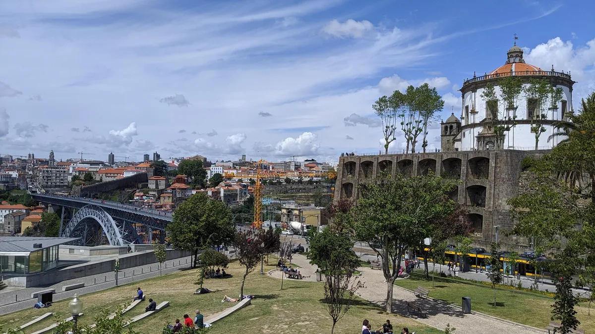
The garden, with the Serra do Pilar above and the bridge on the left. Photo: Dicklyon, CC BY-SA 4.0, via Wikimedia Commons (resized). Now the climb. Go up Rua de Guilherme Braga, the stepped Travessa de Cândido dos Reis and Rua da Barroca, then up the Escadas da Pedrosa to Rua do Pilar and one more flight of steps into the garden. The Jardim do Morro, the "garden on the hill", was laid out in 1927 at the foot of the Serra do Pilar, beside the upper deck of the bridge. Alfredo Moreira da Silva, a well-known gardener born in Grijó, designed it in the 1920s. It has a lake, a bandstand and a row of 22 lime trees along the last stretch of Avenida da República. Gaia's council calls it a balcony over the Douro, a place to watch the sunset and the World Heritage landscape. The cable car's upper station and Jardim do Morro metro station are at its edge.
More history
The cable car's upper station stands some 57 to 63 m above sea level, depending on the source, while its lower station is close to river level. That is roughly the height you have just climbed.
Sources: Wikipedia (pt), Jardim do Morro; Câmara Municipal de Vila Nova de Gaia; Wikipedia, Gaia Cable Car; Wikipedia (pt), Teleférico de Gaia.
-
The Serra do Pilar, a round church and Wellington's lookout
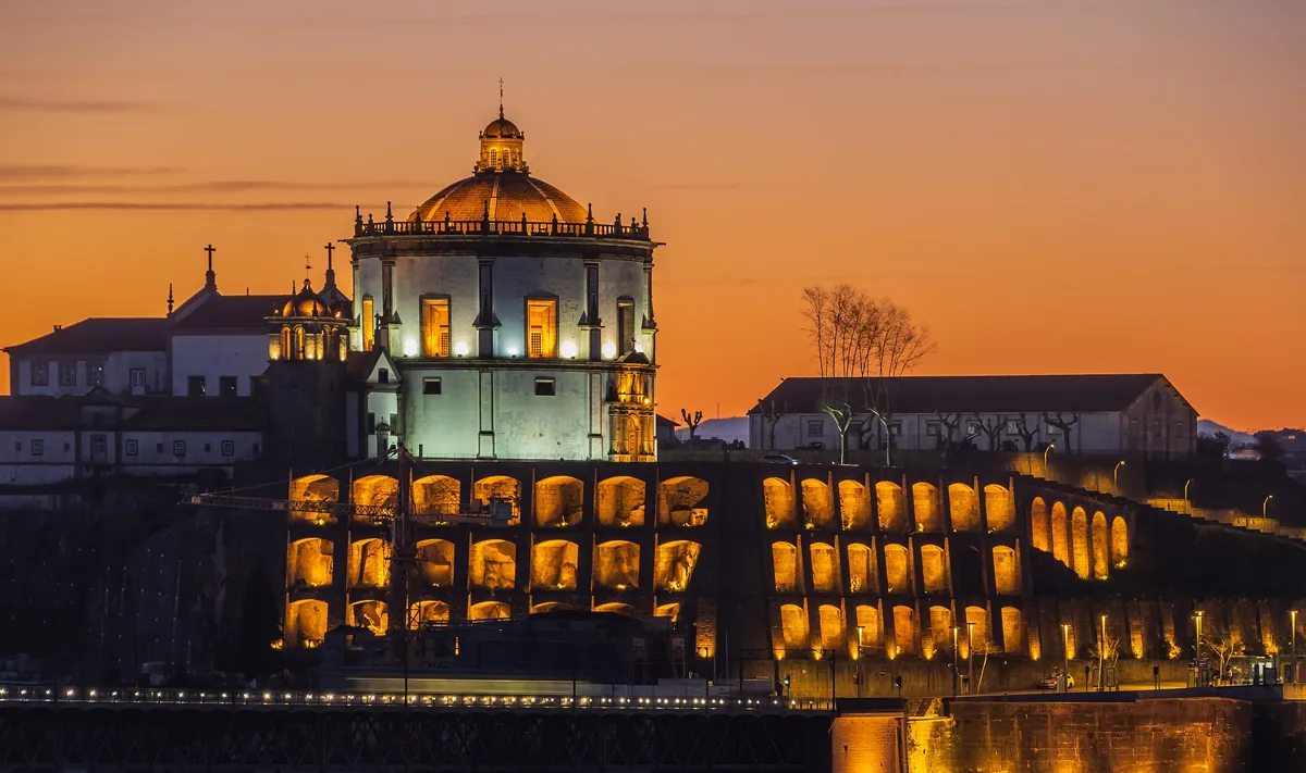
The monastery at dusk. Photo: Krzysztof Golik, CC BY-SA 4.0, via Wikimedia Commons (resized). There is no direct path up. Follow the garden paths south to its far end, cross the metro tracks there and climb the Rampa do Infante Santo, a lane that runs back north up the hillside to Largo de Aviz, the square in front of the monastery. Augustinian canons from the crumbling monastery of Grijó started building here in 1538, backed by King João III. Their first church was soon too small; the present one was begun in 1597 and opened on 17 July 1672. Church and cloister are both round, with the same diameter, and for that Gaia's council counts the monastery among the most remarkable buildings of classical European architecture. The cloister has 36 Ionic columns, and the 36 m church dominates the skyline of the south bank. On 12 May 1809 General Arthur Wellesley, the future Duke of Wellington, had his headquarters here. His men crossed upstream in captured wine barges while his guns fired from the monastery garden, and the French left Porto that day. The church and cloister became a National Monument in 1910, and since 1996 the monastery has been part of the UNESCO World Heritage Site with Porto's historic centre and the bridge.
More history
In the Siege of Porto (1832–33) it was the Liberals' only stronghold on the south bank and was left in ruins. The army still uses part of it. The popular name comes from devotion to Our Lady of the Pillar. Gaia's council says the monastery took her name in 1678; Portuguese Wikipedia says only that, by some accounts, an image of her was placed in the church that year.
Sources: Wikipedia (pt), Mosteiro da Serra do Pilar; Wikipedia, Monastery of Serra do Pilar; Wikipedia, Second Battle of Porto; Câmara Municipal de Vila Nova de Gaia; UNESCO World Heritage Centre.
-
Back to Porto over the upper deck
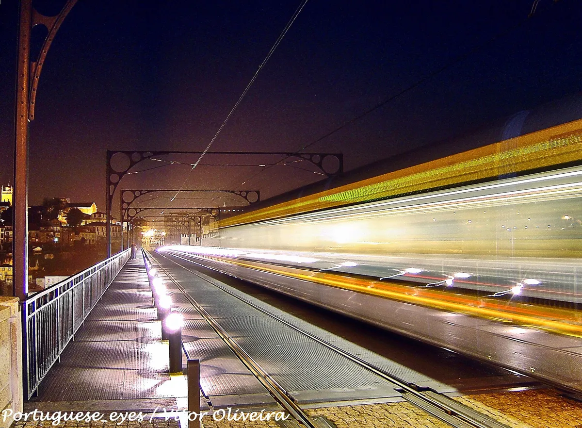
The upper deck at night, with a metro passing. Photo: Vitor Oliveira, CC BY-SA 2.0, via Wikimedia Commons (resized). Go back down the Rampa do Infante Santo to its foot, then follow Avenida da República north beside the metro track and walk out onto the bridge's upper deck, on the walkway next to the rails. The historic centre walk tells how the bridge was built. Up here, the deck was first a road. Electric trams crossed it from 1908 until May 1959, and trolleybuses from 1959 to 1993. It closed to cars on 27 June 2003, three months after the Infante Dom Henrique bridge, 500 m upriver, was finished to take the traffic. On 18 September 2005 it reopened for Metro line D and people on foot. The walk ends at the Porto end of the deck, which leads into the city centre and towards São Bento.
More history
When the bridge opened, 24 gas lamps lit the upper deck, 8 the lower deck and 8 more the ends. The whole iron structure weighed 3,045 tonnes when built, and the bridge is about 385 m long.
Sources: Wikipedia, Dom Luís I Bridge; Wikipedia (pt), Ponte de D. Luís.


Practical details
- Terrain
- Flat along the river, then steep. The quay is close to river level, and the cable car's upper station by the Jardim do Morro stands some 57 to 63 m above sea level. The climb from Santa Marinha to the garden is on narrow lanes and steps. The upper deck is level.
- Step-free
- No. OpenStreetMap maps about 150 steps on the climb to stop 6: 50 on Travessa de Cândido dos Reis, the 69 of the Escadas da Pedrosa and 34 more into the garden. There are also a few steps where the lower deck meets the Gaia quay. To skip the climb, ride the cable car up from near stop 3, or take Metro line D to Jardim do Morro. OpenStreetMap tags the cable car's upper station and Jardim do Morro metro station as wheelchair accessible.
- Water
- OpenStreetMap lists drinking fountains on the Gaia quay by stop 1 and by the Jardim do Morro (stop 6).
- Toilets
- OpenStreetMap shows free toilets at the cable car's upper station by stop 6 (open cable car hours, tagged wheelchair accessible) and free toilets near Corpus Christi (stop 4).
- Sit and eat
- The Cais de Gaia (stops 1–2) is lined with terraces, bars and restaurants. The Mercado da Beira-Rio, by the cable car's lower station, has food stalls inside.
- When to go
- The cable car runs daily 10:00 to 19:00 until 24 October 2026, then 10:00 to 18:00 to the end of the year; it is closed on 25 December. Port lodge visits are paid and booked on the lodges' sites. Gaia's council suggests the Jardim do Morro for sunset. Check church and monastery opening times before you go.
- Shorter walk
- Walk to stop 3 (0.7 km), then ride the cable car up to the Jardim do Morro (stop 6), skipping stops 4 and 5 and the climb.
- Getting back
- São Bento metro station (line D) is about 400 m, 5 minutes on foot, from the finish. Or end at stop 6 or 7 and take Metro line D from Jardim do Morro across the upper deck.
Walking distances and times from the OSRM foot router on OpenStreetMap data. Heights from Wikipedia's cable car articles. Stations, steps, fountains and toilets from OpenStreetMap; cable car hours and prices from Gaia Cable Car; visit prices from Sandeman. Checked 4 October 2026.
Questions people ask
Can you walk across the Dom Luís I bridge?
Yes, on both decks. The upper deck has walkways on both sides of the Metro line D track, open to people on foot since 18 September 2005. The lower deck reopened in April 2023 for public transport, taxis, cyclists and people on foot only. This walk crosses on the lower deck and comes back on the upper one.
Is there a free walking tour of Vila Nova de Gaia?
This page is one you can do on your own, for free: 3.4 km, about 45 minutes of walking and eight stops, so about an hour and a half in all. The map is on this page, and you can print it or save it as a PDF. Only the port lodge visits and the cable car cost money.
Is Vila Nova de Gaia part of Porto?
No. Gaia is a separate city and municipality on the south bank of the Douro, one of the municipalities that make up the Porto metropolitan area. It became a city in 1984, and in 2021 the municipality had 303,824 people. The Serra do Pilar monastery belongs to the same UNESCO World Heritage Site as Porto's historic centre and the Luís I bridge.
Do you need to book port wine cellar tours, and how much do tastings cost?
Visits with tastings are paid, and the lodges sell them on their own sites, so book ahead. In 2026 Sandeman's shortest visit, 50 minutes with three Ports, costs €23, and its other visits cost up to €170. Taylor's sells tickets for an audio-guided visit of its cellars that ends with a tasting. Prices change, so check before you go.
How do you get up to the Serra do Pilar?
On foot it is a steep climb: this walk goes up lanes and about 150 steps, including the 69 of the Escadas da Pedrosa, to the Jardim do Morro, then up the Rampa do Infante Santo. You can also ride the Gaia cable car from the quay to the Jardim do Morro (€7 one way for an adult in 2026), take Metro line D to Jardim do Morro station, or walk across the bridge's upper deck from Porto.
Walk it with Strolio
Open Strolio at the Ribeira end of the Luís I bridge and ask for an hour and a half across the river in Gaia. Strolio builds walks in any city with mapped streets, so its route may pick different stops from this page. Stories play as you reach each place, and you can ask about anything else you pass, by voice or with a photo. You can also start from your hotel and choose your own time and interests.
More walks in Porto
- Downhill to the river: ~90 min, 8 stops. From Livraria Lello and the Clérigos tower past the medieval synagogue site and São Bento's tiles to the Ribeira and the Luís I bridge.
- The Baixa: ~1 h, 7 stops. Porto's downtown on foot: the Avenida dos Aliados, the Bolhão market, two blue-tiled churches and Café Majestic.
- Along the river to Foz: ~2½ h, 8 stops. From the Miragaia customs house past the Crystal Palace gardens and the Arrábida Bridge to the lighthouse at the sea.
- All Porto walks, with maps side by side.
- Walks in other cities.
Sources
- Câmara Municipal de Vila Nova de Gaia, visitor guide (PDF, 2026): the monastery, Corpus Christi, Santa Marinha, the quay, the rabelos, the lodges, the Half-Rabbit and the Jardim do Morro. We used their facts and wrote our own text.
- Instituto dos Vinhos do Douro e do Porto: historical milestones
- Wikipedia (Portuguese): Vila Nova de Gaia, Cais de Gaia, Barco rabelo, Bordalo II, Teleférico de Vila Nova de Gaia, Convento de Corpus Christi, Jardim do Morro, Mosteiro da Serra do Pilar, Ponte de D. Luís
- Wikipedia (English): Vila Nova de Gaia, Tourism in Vila Nova de Gaia, Port wine, Rabelo boat, Sandeman, Bordalo II, Gaia Cable Car, Monastery of Serra do Pilar, Second Battle of Porto, Dom Luís I Bridge
- Lodges and visits: Sandeman, history and cellar visits; Taylor's, cellar visits
- Cable car: Gaia Cable Car, prices and timetable and about the cable car
- UNESCO World Heritage Centre: Historic Centre of Oporto, Luiz I Bridge and Monastery of Serra do Pilar
- Map data and places: © OpenStreetMap contributors, ODbL; walking route from the OSRM foot router at routing.openstreetmap.de
- Photos: Wikimedia Commons contributors Diego Delso, Vitor Oliveira, dlovins99, Carlos Luis M C da Cruz, Dicklyon and Krzysztof Golik, credited under each photo