
Belém self-guided walking tour · Lisbon · 75 minutes · map
Belém on foot: the monastery, the river and the age of the voyages
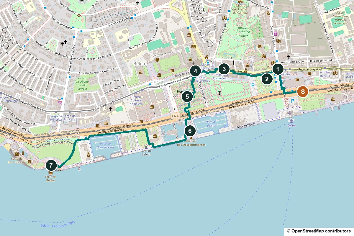
Belém is where Lisbon's ships left for India and Brazil, and where King Manuel I spent the profits on stone. This flat walk of about 75 minutes runs from the royal coach museum and the President's palace to the Jerónimos Monastery, the Padrão dos Descobrimentos and Belém Tower.
At the end of the 15th century the Restelo shore here was a small village and a sheltered anchorage outside the city. Vasco da Gama prayed in its chapel the night before he sailed for India in 1497. Much of what you see on the riverside is newer than it looks: the garden and the first Padrão came with the Portuguese World Exhibition of 1940, which cleared the old centre of Belém, or with the 1960 anniversary of Henry the Navigator's death.
A note on accuracy: some stops are 20th-century monuments to an earlier age, and we say so. Every fact links to its source.
- Start
- Belém station, on the Cascais train line from Cais do Sodré
- Finish
- Belém Tower, 640 m on foot from the Largo da Princesa stop of tram 15E
- Distance
- 2.7 km, one way, all flat
- Time
- About 75 minutes: 36 min walking and 7 stops, plus any visits inside
Terrain, water, opening days and a shorter version ↓
What to see: the stops
-
The Royal Riding School and the National Coach Museum
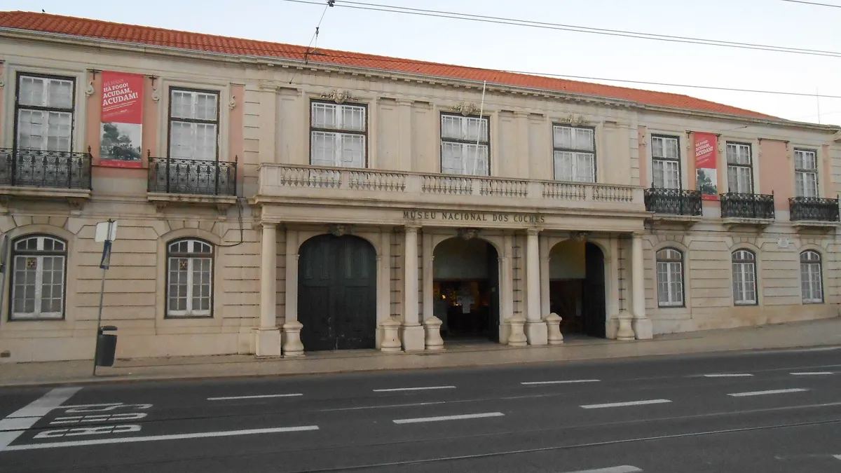
The old Royal Riding School. Photo: Joehawkins, CC BY-SA 4.0, via Wikimedia Commons (resized). From Belém station, take the footbridge over the tracks and walk up the east side of Praça Afonso de Albuquerque to the long building at the top. This is the Royal Riding School of Belém Palace. Prince João, the future King João VI and a keen horseman, had the old riding school pulled down in 1786. The new one was begun in 1787, to a neoclassical design credited to the Italian architect Giacomo Azzolini; its hall is 50 m long and 17 m wide, and the decoration went on until about 1828. In 1905 Queen Amélia turned it into a museum of the royal family's coaches, the first coach museum in the world. In 2015 most of the collection moved to the large modern building beside the station, on Avenida da Índia, designed by the Brazilian Pritzker Prize winner Paulo Mendes da Rocha with Ricardo Bak Gordon. When we checked, the riding school was closed for renovation works; the new museum opens Tuesday to Sunday.
More history
The collection holds ceremonial and travelling coaches from the 16th to the 19th centuries, most of them from the Portuguese royal house. After the 1910 revolution it took in coaches from the church as well, and in 1911 it became the National Coach Museum.
Sources: Museu Nacional dos Coches; Museus e Monumentos de Portugal; Wikipedia, National Coach Museum; Wikipedia (pt), Museu Nacional dos Coches.
-
Belém Palace and Afonso de Albuquerque's column
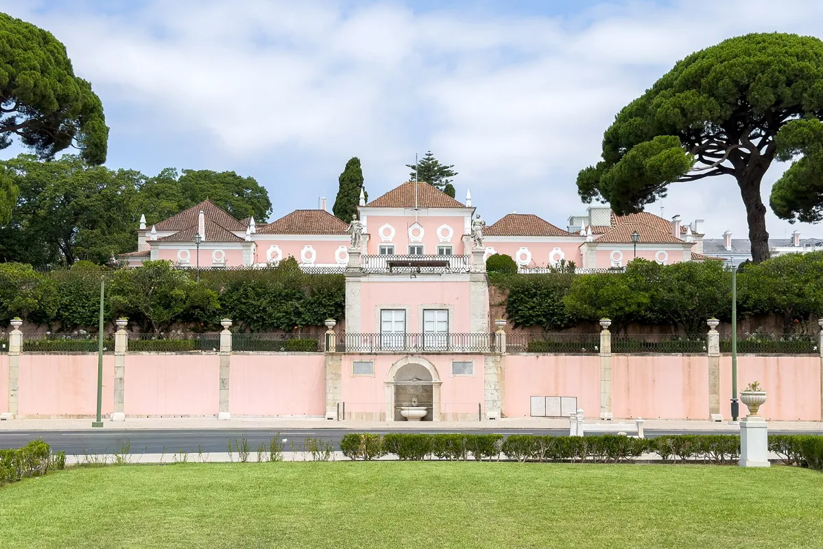
Belém Palace from the square. Photo: Kent Wang, CC BY 4.0, via Wikimedia Commons (resized). Walk west along the top of the square and turn left into the garden, to the tall column in the middle. The pink palace behind you, on the north side of the square, is the official residence of the President of Portugal. King João V bought the estate and, from 1726, rebuilt it as a summer home. When the 1755 earthquake struck, King José I and his family were at Belém for the holiday; they survived and camped in tents in the grounds, while the palace itself served as a hospital. The future King Carlos and Queen Amélia lived here from 1886, and their sons Luís Filipe and Manuel were born here. The presidency has used it since the republic. The column carries a 4 m bronze of Afonso de Albuquerque, the second governor of Portuguese India, cast at the Army Arsenal and unveiled on 3 October 1902. Its base has four reliefs from his life, including the handing over of the keys of Goa.
More history
On the third Sunday of every month at 11:00, the GNR (Guarda Nacional Republicana) changes the palace guard here with about 160 soldiers, a band, a mounted platoon and dogs. The ceremony started in 1969. It ends with the mounted band playing in the Jardim Vieira Portuense; the GNR says it is the only mounted band in the world that plays at a gallop. The square was called Praça D. Fernando until the 1910 revolution.
Sources: GNR, Render Solene da Guarda; Wikipedia, Belém Palace; Wikipedia (pt), Palácio Nacional de Belém; Wikipedia (pt), Praça Afonso de Albuquerque.
-
Pastéis de Belém, the custard tarts from the monastery
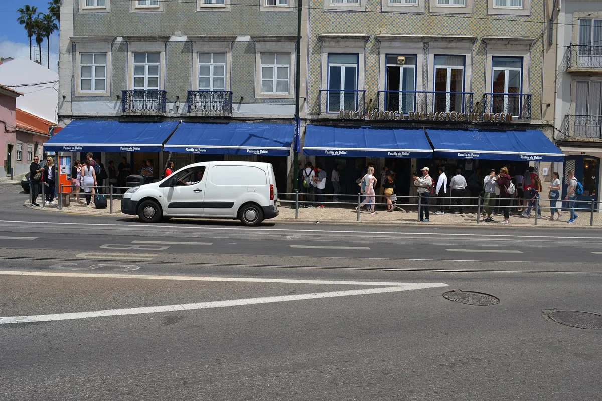
The shop on Rua de Belém. Photo: CardosoSousa1988, CC BY-SA 4.0, via Wikimedia Commons (resized). Go back to the top of the garden and walk west along the path at the top of the Jardim Vasco da Gama, then turn right onto Rua de Belém. The shop is at numbers 84 to 92. Its own history goes like this: in the early 19th century a sugar-cane refinery with a small shop stood beside the monastery. After the Liberal Revolution of 1820, all of Portugal's monasteries were closed in 1834, and someone from the monastery began selling sweet pastries in the shop. Belém was then far from Lisbon and reached by steamboat, but visitors came to see the monastery and the tower, and ate the pastries. In 1837 baking began in buildings next to the refinery, to the monastery's secret recipe, which only the master pastry cooks in its "secret workshop" know. The shop opens every day from 08:00. You can take away or sit in; Wikipedia puts its sales at more than 20,000 tarts a day.
More history
The Portuguese Wikipedia is more careful about the dates. It tells the 1837 founding story as one of the partners gave it to a newspaper in 1983, but the first document tied to the bakery is from 1879, when Domingos Rafael Alves bought the secret of the recipe from his godson by deed. In 2011 the pastry was voted one of Portugal's Seven Wonders of Gastronomy.
Sources: Pastéis de Belém, História; Pastéis de Belém, Contacto; Wikipedia, Pastel de nata; Wikipedia (pt), Pastel de nata.
-
The Jerónimos Monastery and its south door
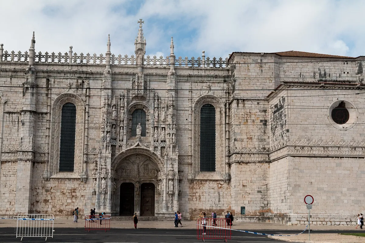
The south door of the monastery church. Photo: Daniel Villafruela, CC BY-SA 3.0, via Wikimedia Commons (resized). Continue west along Rua de Belém, then the paths beside it, to the street called Praça do Império in front of the monastery church. A chapel of the Order of Christ stood here, enlarged by Henry the Navigator in 1459. Vasco da Gama prayed and kept watch in it on the eve of sailing for India in July 1497, and Pedro Álvares Cabral's ships left from here for Brazil in 1500. King Manuel I gave the site to the monks of St Jerome, and the first stone of the new monastery was laid on 6 January 1501 or 1502. A 5% tax on the trade with Africa and the East paid for it. It is built mostly of lioz, a pale local limestone, and took about a hundred years. The south door in front of you was carved in 1517–18 under João de Castilho: 32 m high and over 12 m wide, with Henry the Navigator standing between the two doors and scenes from St Jerome's life above them. Inside the church are the tombs of Vasco da Gama and the poet Luís de Camões, by the sculptor Costa Mota, and those of Manuel I and João III. Tickets are €18; the church keeps its own, shorter hours.
More history
The 1755 earthquake did little damage here. The monks left after religious orders were dissolved in 1833–34, and the buildings went to the Casa Pia charity. The monastery has been a national monument since 1907 and a UNESCO World Heritage Site, with the tower, since 1983. The Treaty of Lisbon, which reformed the European Union, was signed here on 13 December 2007. The long west wing holds the Museu de Marinha, the maritime museum.
Sources: Mosteiro dos Jerónimos e Torre de Belém; official visit page; Wikipedia (pt), Mosteiro dos Jerónimos; Wikipedia, Jerónimos Monastery.
-
The Praça do Império garden, laid out for the 1940 exhibition
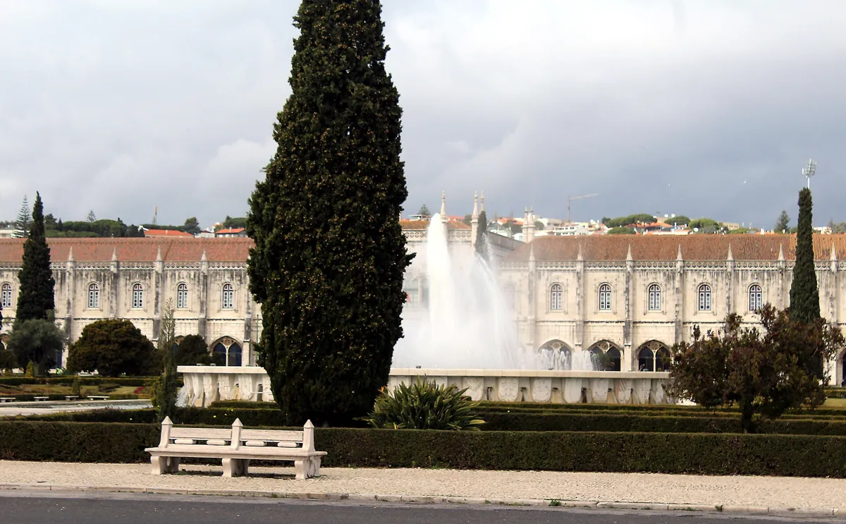
The fountain, with the monastery behind. Photo: Dguendel, CC BY 4.0, via Wikimedia Commons (resized). Cross into the garden opposite the church and walk down its central paths to the big fountain. This area was once a beach, the praia do Restelo. The 3.3-hectare garden was made for the Portuguese World Exhibition, held here from 23 June to 2 December 1940. Its paths divide it into squares around the lit central fountain, and the rim of the fountain's pool carries the coats of arms of navigators of the Discoveries. Thirty coats of arms planted in flowers represent Portugal's districts, its islands and its former colonies; a 2016 redesign that would replace them with grass drew protests and petitions. The seahorse statues at the far corners, by Avenida da Índia, are by António Duarte, from 1940. To the west is the Centro Cultural de Belém, built from 1988 to 1993 to host Portugal's presidency of the European Union in 1992.
Sources: Wikipedia (pt), Jardim da Praça do Império; Wikipedia, Praça do Império; Wikipedia, Belém; Wikipedia (pt), Centro Cultural de Belém.
-
The Padrão dos Descobrimentos and the compass rose
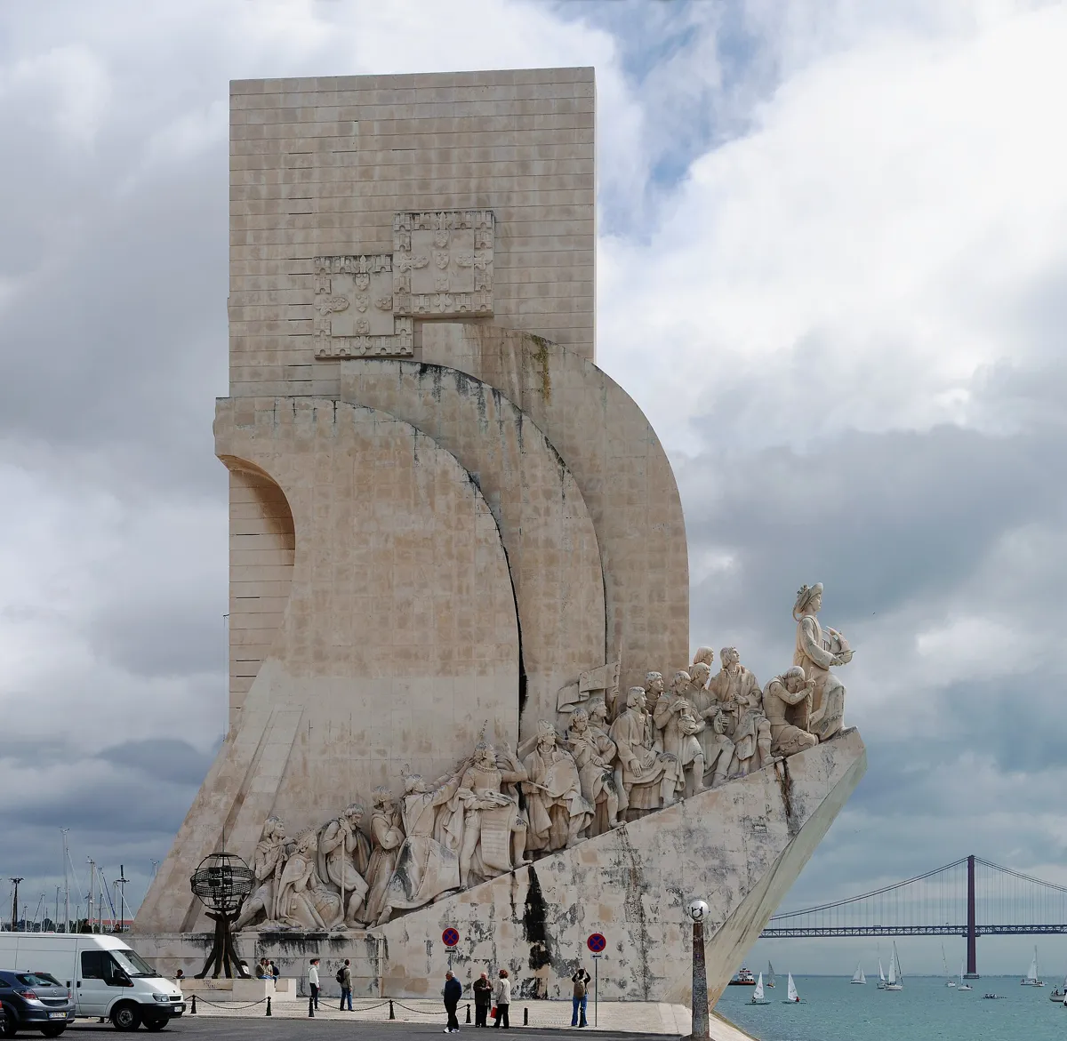
The Padrão from the west. Photo: Alvesgaspar, CC BY-SA 3.0, via Wikimedia Commons (resized). Walk on to the bottom of the garden and take the underpass beneath Avenida da Índia, the railway and Avenida de Brasília to the riverside. The Padrão dos Descobrimentos was designed by the architect Cottinelli Telmo and the sculptor Leopoldo de Almeida for the 1940 exhibition, as a temporary piece of iron, cement and plaster. In 1960, for the 500th anniversary of Henry the Navigator's death, it was rebuilt in concrete and pink Leiria stone, with figures in Sintra limestone. It is shaped like the prow of a caravel: Henry stands at the front, 9 m tall, followed by 32 navigators, mapmakers, soldiers, missionaries, chroniclers and artists, each 7 m tall. The whole thing is 56 m high. In the pavement in front is a compass rose 50 m across, made of black, red and pale limestone, with a world map 14 m wide showing the dates and routes of the voyages. It was unveiled on 5 August 1960, designed in the studio of the architect Luís Cristino da Silva, and an inscription on its south side records it as a gift from South Africa. The official site notes that historians now doubt some of the names and dates set in the stone.
More history
The 1940 version was pulled down by 1943. The monument opened as a cultural centre in 1985, with exhibition rooms, an auditorium and a viewpoint at the top, which you can reach by lift. It opens every day; the viewpoint ticket costs €10.
Sources: Padrão dos Descobrimentos, the monument; the compass rose; Wikipedia, Monument of the Discoveries; Wikipedia (pt), Padrão dos Descobrimentos.
-
Belém Tower, the fort that guarded the river
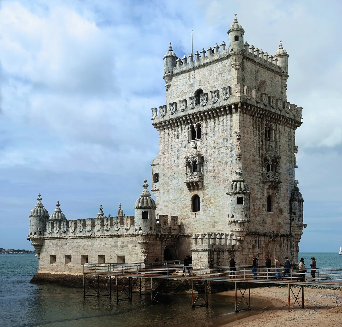
Belém Tower from the north-east. Photo: Alvesgaspar, CC BY-SA 3.0, via Wikimedia Commons (resized). Walk west along the river and, just before the small lighthouse, turn right beside the Museu de Arte Popular, and follow the path along Avenida de Brasília past the Doca do Bom Sucesso marina. Then go down through the garden to the tower. King João II planned a fort here to defend the mouth of the Tagus; under Manuel I, the military architect Francisco de Arruda built it between 1514 and 1519, on a basalt rock a little way off the north bank, and dedicated it to St Vincent. It is often said that the river moved after the 1755 earthquake. In fact the tower was built on a small island near the shore, and the bank grew out to meet it. It joins a tall medieval-style tower to a modern bastion for cannon. Look for twisted rope, knots, armillary spheres and the cross of the Order of Christ, and, under one of the corner turrets, a stone rhinoceros. It is thought to be the first sculpture of a rhinoceros in Western European art, probably the animal Manuel I sent to Pope Leo X in 1515. The loggia on the south side was designed for court ceremonies, likely at their grandest when ships arrived and left.
More history
In 1580 the garrison surrendered to Spanish troops under the Duke of Alba after a few hours. The cells below then served as a prison until 1830; King Miguel I held his liberal opponents there. The tower was also a customs post until 1833. In 1953 the landscape architect António Viana Barreto began a three-year project to integrate it with the shoreline.
Sources: Museus e Monumentos de Portugal, Torre de Belém; Mosteiro dos Jerónimos e Torre de Belém; Wikipedia, Belém Tower; Wikipedia (pt), Torre de Belém.


Practical details
- Terrain
- Flat: Open-Meteo puts every stop between about 3 and 11 m above sea level. Wide pavements, garden paths and a riverside promenade.
- Step-free
- OpenStreetMap shows steps in four places on the route: the footbridge at Belém station (45 steps up from the platform, then a spiral stair down on the far side); two short flights in the Praça do Império garden, one of 8 steps just below the fountain; the underpass to the Padrão (steps at both ends, 30 on the river side, both mapped with a ramp); and 7 steps with a wheelchair ramp just before the tower. OpenStreetMap marks Belém station as wheelchair accessible. At Jerónimos the church and the ground floor of the cloister are fully accessible, the upper cloister is not; at the tower, only the ground floor of the bastion is.
- Water
- OpenStreetMap lists drinking fountains by Praça Afonso de Albuquerque, about 40 m from stop 2, and near the monastery, about 50 m from stop 4.
- Toilets
- OpenStreetMap shows a free city-run public toilet by Praça Afonso de Albuquerque, a paid automatic one about 40 m from Pastéis de Belém, and paid toilets about 200 m from the tower. Jerónimos has toilets inside the cloister.
- Sit and eat
- Pastéis de Belém (stop 3) serves to sit in or take away, and opens every day from 08:00 to 21:00, until 22:00 from July to September.
- When to go
- Avoid Mondays: Jerónimos, the tower and the coach museum close. Jerónimos and the tower open Tuesday to Sunday, 09:30 to 17:30 (last entry 17:00, ticket desks close 16:30); the church opens 10:30 to 17:00, Sundays and religious holidays 14:00 to 17:00. Both close on 1 January, Easter Sunday, 1 May, 13 June and 25 December. The Padrão opens daily, 10:00 to 18:00 from October to February and 10:00 to 19:00 from March to September. The guard changes at the palace on the third Sunday of the month at 11:00.
- Shorter walk
- Finish at stop 6, the Padrão: 1.6 km, about 50 minutes. Belém station is about 1 km back east, 13 minutes on foot.
- Getting back
- Tram 15E to Praça da Figueira stops at Largo da Princesa, 640 m from the tower on foot. Belém station is about 2 km back along the river, 26 minutes on foot.
Walking distances and times from the OSRM foot router on OpenStreetMap data. Elevations from Open-Meteo. Stations, fountains, toilets and steps from OpenStreetMap; opening hours and prices from the Jerónimos and Belém Tower, Padrão dos Descobrimentos, Museus e Monumentos de Portugal and Pastéis de Belém sites. Checked 4 October 2026.
Questions people ask
How long does the Belém walking tour take, and is there a map?
About 75 minutes without going inside anything: 2.7 km, 36 minutes of walking and seven stops, from Belém station to Belém Tower. The map is on this page, and you can print it or save it as a PDF. Add an hour or more for each monument you visit inside.
How do you get to Belém from central Lisbon?
By train on the Cascais line from Cais do Sodré to Belém station, where this walk starts; some fast trains to Cascais do not stop there, so check before you board. Tram 15E, which runs between Praça da Figueira and Algés, also stops in Belém, by Praça Afonso de Albuquerque and by the monastery.
Is Jerónimos Monastery free, and when is it closed?
It is not free for most visitors: a ticket costs €18, half price for people over 65 and young people aged 13 to 24. Children up to 12 go free, and residents of Portugal get 52 free days a year under the Acesso 52 scheme. It is closed on Mondays, 1 January, Easter Sunday, 1 May, 13 June and 25 December. Tickets often sell out, so buy online in advance.
Is Belém Tower worth going inside?
From outside you see what makes it famous: the Manueline carving, the loggia over the river and the stone rhinoceros under a corner turret. Inside, the bastion and four floors of the tower cost €15, and people with reduced mobility can reach only the ground floor. When we checked, the official English visit page said the tower was temporarily closed for conservation work, while the Portuguese page and Museus e Monumentos de Portugal listed normal hours, so check before you go.
Are Pastéis de Belém the original pastéis de nata?
The shop says it has made them since 1837 to an old recipe from the Jerónimos monastery, still known only to the pastry cooks in its secret workshop. Wikipedia describes the pastéis de nata sold elsewhere as variations inspired by this recipe. The Portuguese Wikipedia adds that the first document tied to the bakery dates from 1879.
Walk it with Strolio
Open Strolio at Belém station and ask for 75 minutes through Belém to the tower. Strolio builds walks in any city with mapped streets, so its route may pick different stops from this page. Stories play as you reach each place, and you can ask about anything else you pass, by voice or with a photo. You can also start from your hotel and choose your own time and interests.
More walks in Lisbon
- Alfama: ~75 min, 8 stops. From the river up past Lisbon's fortress cathedral and two viewpoints to São Vicente and the church that took 284 years to finish. Steep.
- Baixa and Chiado: ~75 min, 8 stops. Pombal's grid rebuilt after the 1755 earthquake, up to the roofless Carmo church and Pessoa's café.
- Bairro Alto and Príncipe Real: ~70 min, 7 stops. From the river up the Bica hill on foot, through a 16th-century street grid and two viewpoints to a reservoir hidden under a garden lake. Steep, with stairs.
- All Lisbon walks, with maps side by side.
- Walks in other cities.
Sources
- Official sites: Mosteiro dos Jerónimos e Torre de Belém (visiting), Museus e Monumentos de Portugal, Torre de Belém and Museu Nacional dos Coches, Museu Nacional dos Coches, Padrão dos Descobrimentos (compass rose, tickets), Pastéis de Belém, GNR, changing of the guard. We used their facts and wrote our own text.
- Wikipedia (Portuguese): Mosteiro dos Jerónimos, Torre de Belém, Padrão dos Descobrimentos, Palácio Nacional de Belém, Praça Afonso de Albuquerque, Museu Nacional dos Coches, Pastel de nata, Jardim da Praça do Império, Centro Cultural de Belém, Estação Ferroviária de Belém
- Wikipedia (English): Jerónimos Monastery, Belém Tower, Monument of the Discoveries, Belém Palace, National Coach Museum, Pastel de nata, Praça do Império, Belém, Cascais Line
- Map data, stations and tram routes: © OpenStreetMap contributors, ODbL; walking route from the OSRM foot router at routing.openstreetmap.de run by FOSSGIS
- Elevations: Open-Meteo
- Photos: Wikimedia Commons contributors Joehawkins, Kent Wang, CardosoSousa1988, Daniel Villafruela, Dguendel and Alvesgaspar, credited under each photo