
Edinburgh New Town self-guided walking tour · 1.5 hours · map
Edinburgh's New Town on foot: James Craig's grid, Charlotte Square and the Scott Monument
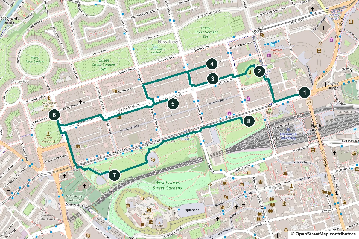
Edinburgh's New Town was planned in the 1760s as a tidy grid on the ridge north of the Old Town. This walk of about an hour and a half follows that plan from Register House and St Andrew Square to Charlotte Square, then drops into Princes Street Gardens for the castle view and ends at the Scott Monument.
The walled Old Town had become badly overcrowded. Lord Provost George Drummond pushed the town's boundary north over the fields beyond the Nor Loch, a polluted loch in the valley. In January 1766 James Craig, then 26, won a competition for the plan: a grid with a main street along the ridge between two garden squares. The council adopted his final plan in July 1767, and the New Town grew in stages until about 1850. Many New Town residents had money from the slave trade or slave plantations. Since 1995 the Old and New Towns have been one UNESCO World Heritage Site.
A note on accuracy: most of Princes Street was rebuilt for shops in the 19th century. Where a building has been rebuilt or changed, we say so, and every fact links to its source. The Old Town across the valley has its own walk: the Royal Mile.
- Start
- General Register House, east end of Princes Street, across the road from Edinburgh Waverley station
- Finish
- Scott Monument, East Princes Street Gardens, about 180 m from Waverley
- Distance
- 3.2 km, one way
- Time
- About an hour and a half: 43 min walking and 8 stops, plus any climb of the Scott Monument
Terrain, toilets, opening times and a shorter version ↓
What to see: the stops
-
General Register House, Robert Adam's record office
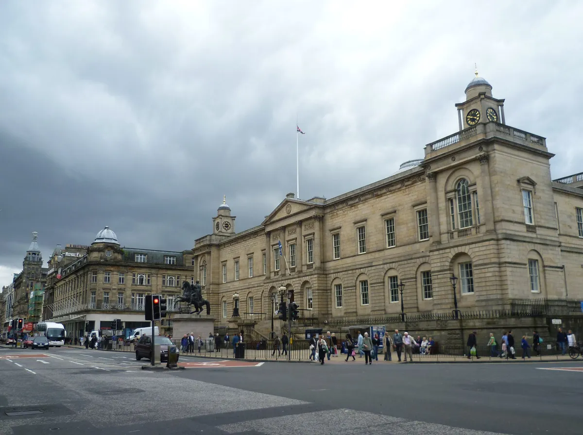
Register House and the Wellington statue from Princes Street. Photo: Kim Traynor, CC BY-SA 3.0, via Wikimedia Commons (resized). Start at the Duke of Wellington on his rearing horse, in front of Register House at the east end of Princes Street. Robert Adam designed this building, Britain's first purpose-built record office, and it still holds Scotland's records. The city gave the site in 1769 to help the New Town along. The foundation stone was laid on 27 June 1774, but work dragged: Robert Reid finished the north range only in 1834. The front corner towers carry a clock and a wind vane by Benjamin Vulliamy, put up in 1790. John Steell's Wellington went up in 1852, and Scottish veterans of Waterloo were invited to the unveiling.
More history
Before this, Scotland's records were kept in Edinburgh Castle. Part of the money for the new building came from estates taken from Jacobites.
Sources: Historic Environment Scotland, listing LB27636; Wikipedia, General Register House.
-
St Andrew Square: the Melville Monument and Dundas House
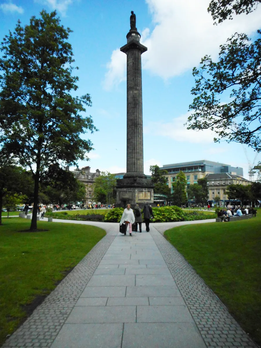
The Melville Monument from the square's gardens. Photo: Richard Sutcliffe, CC BY-SA 2.0, via Wikimedia Commons (resized). Walk west along Princes Street, across the end of West Register Street, and turn right up South St Andrew Street into St Andrew Square. Go into the gardens, public since 2008, and stand east of the column. It honours Henry Dundas, 1st Viscount Melville, who by 1796 controlled all but two of Scotland's MPs. William Burn modelled it on Trajan's Column in Rome. Royal Navy officers raised most of the money, and it went up in 1821–23 under the engineer Robert Stevenson. Chantrey's statue was hauled to the top in 1827, facing west along George Street. Dundas argued for a gradual end to the slave trade rather than immediate abolition; since 2021 a council plaque on the base blames him for delaying it. Behind you, on the east side of the square, is Dundas House. Craig meant its forecourt for a church, but Sir Laurence Dundas bought the ground first and had William Chambers design him a mansion in 1771. The Royal Bank of Scotland bought it in 1825; it is still the bank's registered head office.
More history
The bank's domed hall behind the house, from 1857, has a ceiling of glazed stars, a pattern used on its banknotes. The philosopher David Hume moved to the square, persuaded by Robert Adam.
Sources: Historic Environment Scotland, LB27816 and LB29705; Wikipedia, Melville Monument; Wikipedia, St Andrew Square; Wikipedia, Royal Bank of Scotland.
-
St Andrew's Church, the oval church of the Disruption
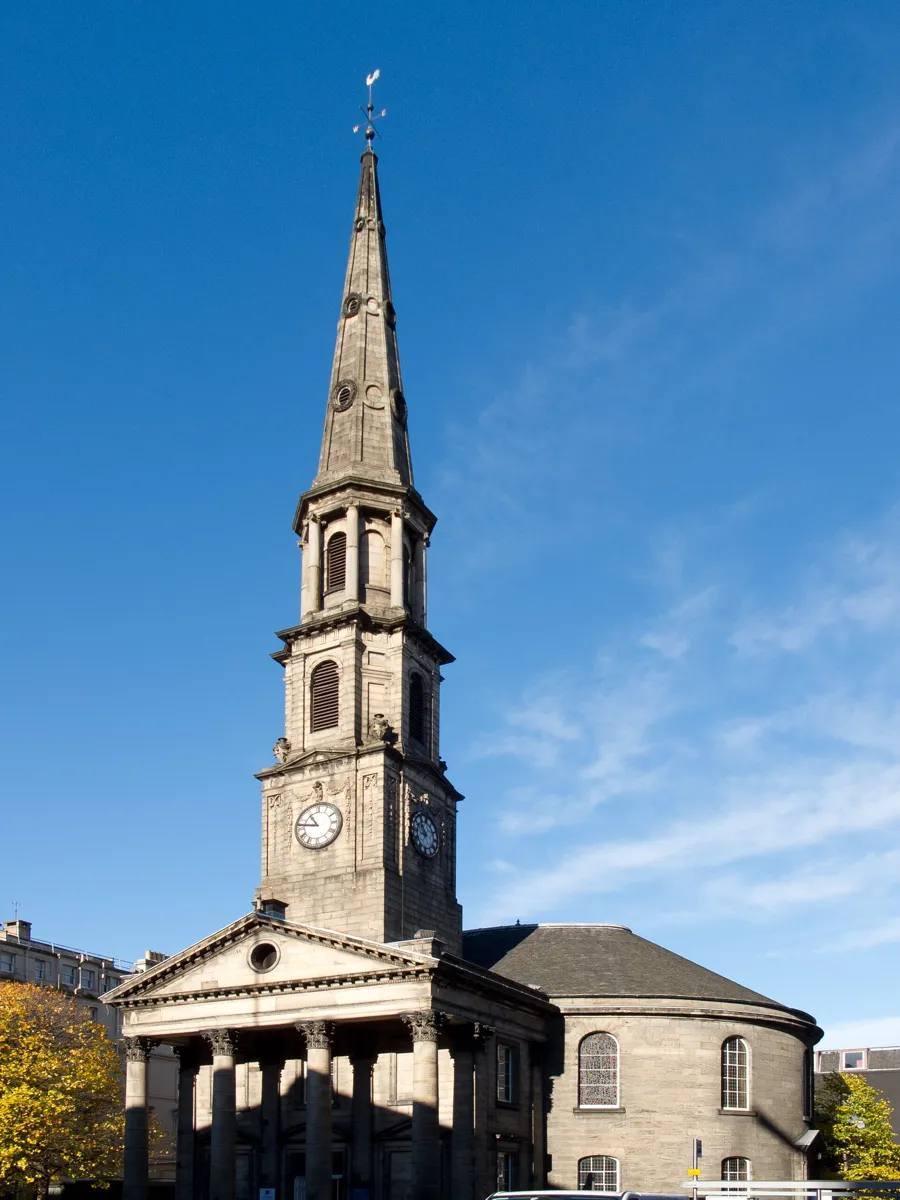
The portico, steeple and oval body of the church. Photo: Carlos Delgado, CC BY-SA 3.0, via Wikimedia Commons (resized). Leave the gardens on the west side and walk into George Street, past a statue of the physicist James Clerk Maxwell from 2008. The church is on your right at No. 13. With the square taken by Dundas, the council found this plot in 1781. It was shallow, which partly explains the oval plan, the first important church of this shape in Britain. The army engineer Andrew Frazer designed it; it opened in 1784, and the 51 m steeple followed in 1787. Its eight bells of 1788 are the oldest complete ring in Scotland. In 1843 the church saw the Disruption, when about a third of the ministers at the Church of Scotland's General Assembly walked out and founded the Free Church of Scotland. Across the street, the Dome at No. 14, built in 1847 as a bank, stands on the site of the main New Town building Craig designed himself: the Physicians' Hall of 1781, pulled down around 1843.
More history
Inside, a gallery with original box pews runs round the oval under a ceiling with Scottish thistles among the Roman ornament.
Sources: Historic Environment Scotland, LB27283; Wikipedia, Edinburgh: New Town Church; Wikipedia, George Street; Wikipedia, James Craig.
-
Thistle Court, the New Town's oldest houses
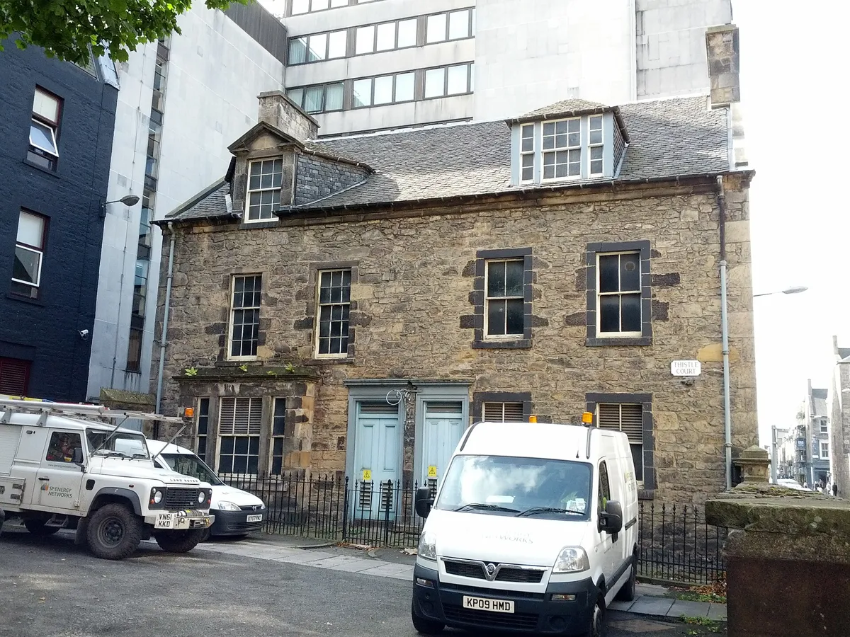
Nos 3 and 4 Thistle Court. Photo: Afmell, CC BY-SA 3.0, via Wikimedia Commons (resized). Walk west along George Street to Hanover Street, where Chantrey's bronze George IV marks the king's visit of 1822. Turn right up Hanover Street, then right into Thistle Street; Thistle Court opens on your right after about 100 m. Craig's street names made a political point. George Street honours George III and Queen Street his queen; the narrow Thistle Street and Rose Street stand for Scotland and England. The southern street was to be St Giles Street, but the king objected, and it became Princes Street. At first the exposed site was unpopular, so a £20 prize was offered to the first builder. John Young won it, and in 1767 he built Thistle Court: two pairs of plain houses facing each other across a little yard. Historic Environment Scotland calls them probably the oldest buildings left in the New Town. Note the rubble walls and the iron gates with thistle fretwork. One pair is now an electricity substation.
More history
Thistle Street is only half as long as Rose Street, because its western blocks were renamed Hill Street and Young Street.
Sources: Historic Environment Scotland, LB43351 and LB29836; Wikipedia, New Town. On the way: HES, statue of George IV.
-
The Assembly Rooms, George Street's ballroom
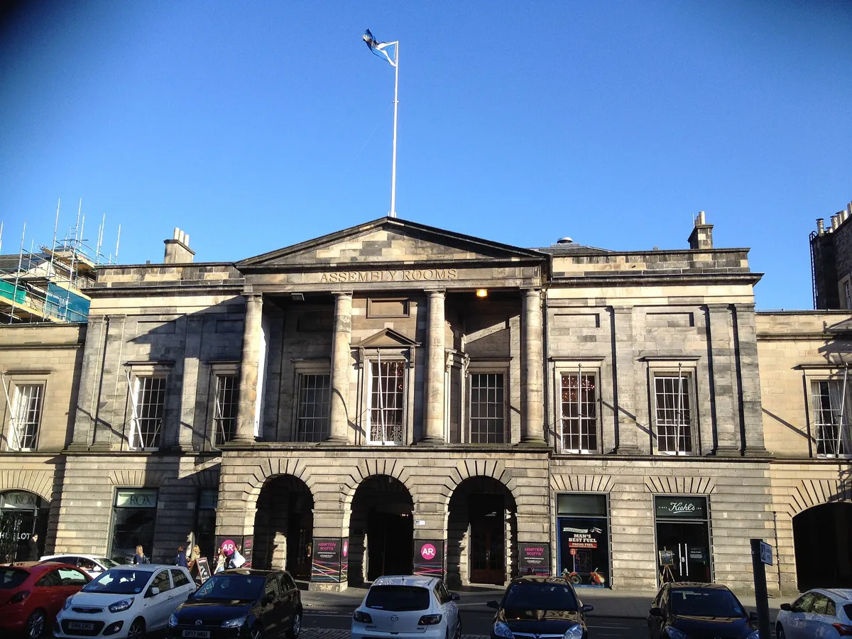
The Assembly Rooms at 54 George Street. Photo: SylviaStanley, CC BY-SA 4.0, via Wikimedia Commons (resized). Walk back west along Thistle Street, across Hanover Street, to Frederick Street. Turn left down Frederick Street, then left into George Street; the Assembly Rooms are on your right at No. 54. They opened on 11 January 1787 with the Caledonian Hunt Ball. They were paid for by public subscription and cost over £6,000, and the town council gave the site. John Henderson won the design competition in 1781. The portico was added by William Burn in 1817–18. During George IV's visit in August 1822 a Peers' Ball was held here. The city has owned the building since 1945; it is a Festival Fringe venue. George Street itself began as houses, but in Victorian times most were replaced by banks, shops and hotels, and many are now bars and restaurants.
More history
Burn and David Bryce added the Music Hall behind in 1843. A £9.3 million refurbishment began in 2011.
Sources: Historic Environment Scotland, LB27567; Wikipedia, Assembly Rooms; Wikipedia, George Street.
-
Charlotte Square, Robert Adam's finale
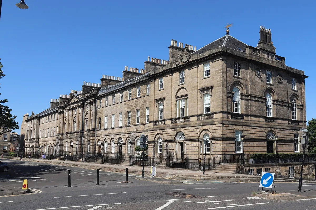
Nos 1–11 on the north side, including Bute House. Photo: Mike Shaw, CC BY-SA 4.0, via Wikimedia Commons (resized). Walk west along George Street, past Chantrey's William Pitt at Frederick Street and the churchman Thomas Chalmers at Castle Street. At Charlotte Square, cross to the north-east corner and look west along the north side. Craig called it St George's Square; in 1786 it was renamed after Queen Charlotte. In 1791 the council asked Robert Adam to design it so the New Town would end in style. He died in 1792, just as building began. The north side, built 1793–1805, follows his design: eleven houses behind one palace front, with sphinxes on the end pavilions. The middle house, No. 6, is Bute House, official residence of every First Minister of Scotland since 1999. No. 7, the Georgian House, was finished in 1796 and sold for £1,800 to John Lamont, chief of Clan Lamont. The National Trust for Scotland has restored it as a home of around 1800, but at the time of writing it was closed for conservation work. On the west side, the green dome of West Register House, built in 1811–14 as St George's Church, closes the view down George Street.
More history
The 4th Marquess of Bute, who owned the middle houses, persuaded his neighbours to strip Victorian dormers and windows from the north side to bring back Adam's design.
Sources: Historic Environment Scotland, LB28502; Wikipedia, Charlotte Square; Wikipedia, Bute House; Wikipedia, The Georgian House; Wikipedia, West Register House. On the way: HES, statue of Pitt. Visiting: Edinburgh247 listing; check the National Trust for Scotland's page for reopening.
-
The Ross Fountain and the castle view
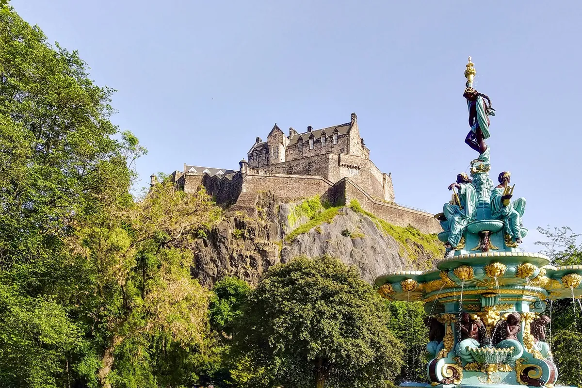
The Ross Fountain below the castle, after its 2018 restoration. Photo: Matti Blume, CC BY-SA 4.0, via Wikimedia Commons (resized). Walk down the east side of the square into South Charlotte Street, cross Rose Street and Princes Street, and enter West Princes Street Gardens by the gate opposite. Follow the path left and down the steps to the fountain. These gardens fill the valley of the drained Nor Loch. They were laid out around 1820 for the Princes Street householders and became a public park in 1876. The fountain was cast in iron by Antoine Durenne's foundry in France and shown at the 1862 International Exhibition in London. The Edinburgh gunmaker Daniel Ross bought it and gave it to the city; it reached Leith in 122 pieces and was put up here in 1872. Mermaids pour water from urns, and four women stand for Science, Art, Industry and Poetry. Not everyone approved: Dean Ramsay of nearby St John's church called it "grossly indecent and disgusting". It was restored and repainted turquoise and gold in 2018. Behind it, the castle rock rises straight up.
More history
While the gardens were private, their rules banned dogs, cricket, prams and smoking. People in bath chairs needed a doctor's note saying their illness was not catching.
Sources: Historic Environment Scotland, LB27911; Wikipedia, Ross Fountain; Wikipedia, Princes Street Gardens.
-
The Scott Monument
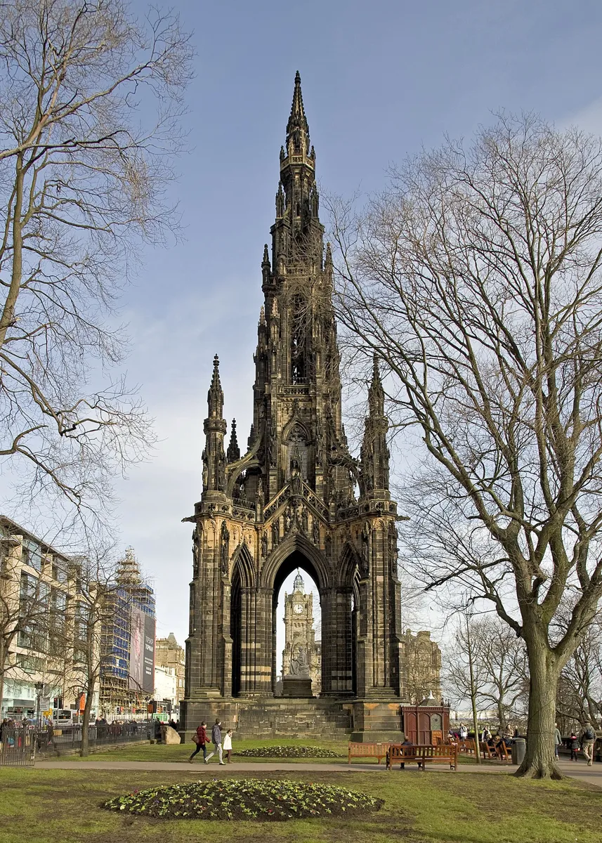
The Scott Monument from East Princes Street Gardens. Photo: Saffron Blaze, CC BY-SA 3.0, via Wikimedia Commons (resized). Follow the path east past the Ross Bandstand and up to Princes Street near Frederick Street. Turn right along Princes Street, past the floral clock at the corner of The Mound, first planted in 1903. Cross The Mound, carry on along Princes Street and turn into East Princes Street Gardens for the monument. After the novelist Sir Walter Scott died in 1832, a design competition for a memorial was won in 1838 by George Meikle Kemp, a joiner and self-taught architect who entered as "John Morvo", the medieval architect of Melrose Abbey, which inspired his design. The monument was first meant for Charlotte Square; its foundation stone was laid in 1840. Kemp never saw it finished: he drowned in the Union Canal on a foggy night in March 1844, and the tower was completed that autumn. It is 61 m high and carries 64 figures of characters from Scott's novels. Under the arches sits John Steell's Scott with his dog Maida, carved from a single 30-ton block of Carrara marble. Waverley station is named after Scott's Waverley novels. On a guided tour you can climb 287 steps to the top platform.
More history
The hard Binny sandstone was deadly for the masons who shaped it indoors, breathing its dust; one observer said the monument killed 23 of the best stone-cutters in Edinburgh.
Sources: Historic Environment Scotland, LB27829; Wikipedia, Scott Monument; Wikipedia, Princes Street. Visiting: Culture Edinburgh, Scott Monument. On the way: City of Edinburgh Council, Princes Street Gardens management plan (floral clock).


Practical details
- Terrain
- George Street runs along the top of a ridge, so the cross streets slope down from it. Princes Street Gardens lie well below Princes Street, behind a steep bank, so expect a climb back up after the fountain.
- Step-free
- Not fully. OpenStreetMap maps a flight of 32 steps on the route down to the Ross Fountain, and short steps at the St Andrew Square gardens and Charlotte Square. It marks Waverley station and the St Andrew Square and Princes Street tram stops as wheelchair accessible. The Scott Monument is stairs only.
- Water
- OpenStreetMap shows no drinking fountains on the route.
- Toilets
- Free council toilets, both with an accessible toilet, in West Princes Street Gardens: near the Ross Fountain (10am to 8pm) and at the Ross Bandstand (10am to 7pm), according to the City of Edinburgh Council.
- Sit and eat
- George Street is lined with restaurants, cafés and bars, many in old banks. Rose Street, which you cross before stop 7, is known for its pubs.
- When to go
- The Scott Monument opens every day; tours run every 30 minutes from 10:30 to 4:30, with a lunch break from 12:30 to 1:45. Tickets are £9, or £7 for concessions and children, card only, sold on the day; no under-fives. The Georgian House was closed for conservation work at the time of writing. The council's 2017–2020 management plan for Princes Street Gardens says the gates open at 7am and close at dusk, or 6pm in winter.
- Shorter walk
- Finish at stop 6, Charlotte Square: about 2 km and an hour. Princes Street, a block south, is served by trams and buses.
- Getting back
- From the Scott Monument, Waverley station is about 180 m away, the St Andrew Square tram stop about 250 m and the Princes Street tram stop about 290 m.
Walking distances and times from the OSRM foot router on OpenStreetMap data. Stations, steps and toilets from OpenStreetMap; toilet hours from the City of Edinburgh Council; Scott Monument times and prices from Culture Edinburgh. Prices and hours change, so check before you go. Checked 4 October 2026.
Questions people ask
How long does the Edinburgh New Town walking tour take, and is there a map?
About an hour and a half: 3.2 km, 43 minutes of walking and eight stops, from Register House at the east end of Princes Street to the Scott Monument, about 180 m from Waverley station. Allow extra time if you climb the monument. The map is on this page, and you can print it or save it as a PDF.
Why is it called the New Town?
Because it was built new, from 1767, on open fields north of the crowded medieval Old Town. The city stretched its boundary over the land beyond the Nor Loch, and James Craig's competition-winning plan laid out the first streets. Later extensions to the north, west and east went on until about 1850.
Is the New Town part of the UNESCO World Heritage Site?
Yes. The Old and New Towns of Edinburgh were inscribed together as one World Heritage Site in 1995. UNESCO points to the contrast between the medieval Old Town and the planned Georgian New Town, and to the New Town's influence on town planning across Europe.
Can you climb the Scott Monument?
Yes, on a guided tour. Tours start every 30 minutes from 10:30 to 4:30, with a lunch break from 12:30 to 1:45. Tickets are sold at the kiosk on the day, by card only: £9 for adults and £7 for concessions and children. The highest platform is 287 steps up, there is no lift, and children under five are not allowed. Check before you go.
What is the difference between Edinburgh's Old Town and New Town?
The Old Town grew without a plan below the castle, with cramped tenements in narrow closes. The New Town was planned as a grid from 1767, with wide streets, garden squares and neo-classical stone terraces. Princes Street Gardens, in the valley of the drained Nor Loch, lie between the two. Our Royal Mile walk covers the Old Town.
Walk it with Strolio
Open Strolio at Register House and ask for an hour and a half through the New Town. Strolio builds walks in any city with mapped streets, so its route may pick different stops from this page. Stories play as you reach each place, and you can ask about anything else you pass, by voice or with a photo. You can also start from your hotel and choose your own time and interests.
More walks in Edinburgh
- The Royal Mile: ~1½ h, 8 stops. From Greyfriars Bobby and Victoria Street up to the Castle and down the Royal Mile to Holyrood.
- Dean Village and Stockbridge: ~1 h, 8 stops. Telford's Dean Bridge, the old milling village, the Water of Leith to Stockbridge and cobbled Circus Lane.
- Calton Hill to Arthur's Seat: 2–3 h, 8 stops. The Calton Hill monuments, a ruined chapel and an extinct volcano: a real hill walk up Arthur's Seat.
- All Edinburgh walks, with maps side by side.
- Walks in other cities.
Sources
- Historic Environment Scotland, listed building records: the record for each building or statue, linked under each stop. We used their facts and wrote our own text.
- UNESCO World Heritage Centre: Old and New Towns of Edinburgh
- Wikipedia: New Town, Edinburgh, Edinburgh, James Craig, General Register House, Melville Monument, St Andrew Square, Royal Bank of Scotland, Edinburgh: New Town Church, George Street, Assembly Rooms, Charlotte Square, Bute House, The Georgian House, West Register House, Rose Street, Princes Street, Princes Street Gardens, Ross Fountain, Scott Monument
- Opening times and visits: Culture Edinburgh, Scott Monument, National Trust for Scotland, The Georgian House, Edinburgh247, City of Edinburgh Council public toilets and Princes Street Gardens management plan
- Map data and places: © OpenStreetMap contributors, ODbL; walking route from the OSRM foot router run by FOSSGIS
- Photos: Wikimedia Commons contributors Kim Traynor, Richard Sutcliffe, Carlos Delgado, Afmell, SylviaStanley, Mike Shaw, Matti Blume and Saffron Blaze, credited under each photo